Hurricane Andrew Is Given a Bigger Punch
- Share via
MIAMI — U.S. scientists said Hurricane Andrew, which devastated parts of South Florida in 1992, was stronger than they previously thought and reclassified it Wednesday as a catastrophic “Category 5” storm on the scale that measures hurricane intensity.
Only two other Category 5 hurricanes are known to have struck the United States--an unnamed one that hit the Florida Keys in 1935 and Hurricane Camille, which hit Mississippi and Louisiana in 1969.
“It makes Andrew a very, very rare event,” National Hurricane Center Director Max Mayfield said. “That’s in a way good news because it is such a rare event.”
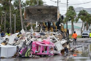
Hurricane Andrew slammed into the record books as the most costly natural disaster in U.S. history when it cut across the Florida Peninsula south of Miami on Aug. 24, 1992, killing 28 people in Florida and Louisiana and causing more than $25 billion in damage.
No one will ever know for sure how strong Andrew was because it blew away all the wind-measuring devices in its path, Mayfield said.
Researchers initially estimated it had top sustained winds of 145 mph when it crossed the coastline, making it a Category 4 hurricane on the five-step Saffir-Simpson scale that rates hurricane intensity.
Hurricane experts now estimate that those winds were 165 mph with gusts stronger than 200 mph, putting Andrew solidly over the 155 mph threshold for Category 5 status.
The upgrade was based on new analysis of data collected in 1992, and on a better understanding of a hurricane’s internal workings.
Researchers in so-called hurricane-hunter planes measured Andrew’s upper winds as they flew over it at 10,000 feet. Using what was then the standard formula, they calculated that the winds at the surface--the ones that cause the damage on the ground--were about 75% or 80% as strong as those at flight level.
They now know the surface winds are usually more like 90% as strong as those at flight level, and that new formula pegged Andrew’s sustained winds at 165 mph.
The reclassification resulted from an ongoing review of U.S. hurricanes dating to 1851 by researchers with the National Oceanic and Atmospheric Administration.
Mayfield said the reclassification would have made no difference on the watches and warnings issued as Andrew loomed. But the information, Mayfield said, was valuable because “society needs an accurate accounting of the intensity of past catastrophic events to best plan for the future.”
The new formulas come largely from data gathered by dropsondes, which are tubes of instruments dropped out of planes into the intense wall of winds around a hurricane’s eye.
The dropsondes record wind speed, atmospheric pressure, water vapor levels and temperatures inside the storm. They relay a new data to the plane for every 15 feet they fall and mark their location via global positioning satellites.
Researchers began using them in 1997 and have since dropped 400 of them into hurricanes, collecting enough measurements to tweak the formulas used to calculate intensity.
“We’re beginning to understand what makes storms strong,” said researcher James Franklin, who presented data to the NOAA/National Hurricane Center committee that made the upgrade decision.
More to Read
Sign up for Essential California
The most important California stories and recommendations in your inbox every morning.
You may occasionally receive promotional content from the Los Angeles Times.


