Key questions unanswered in Kobe Bryant crash as NTSB prepares preliminary report

- Share via
The National Transportation Safety Board is moving closer to releasing preliminary findings in the Jan. 26 helicopter crash that killed Kobe Bryant and eight others.
In the 11 days since the Calabasas crash, some details have been revealed. But many questions remain unanswered.
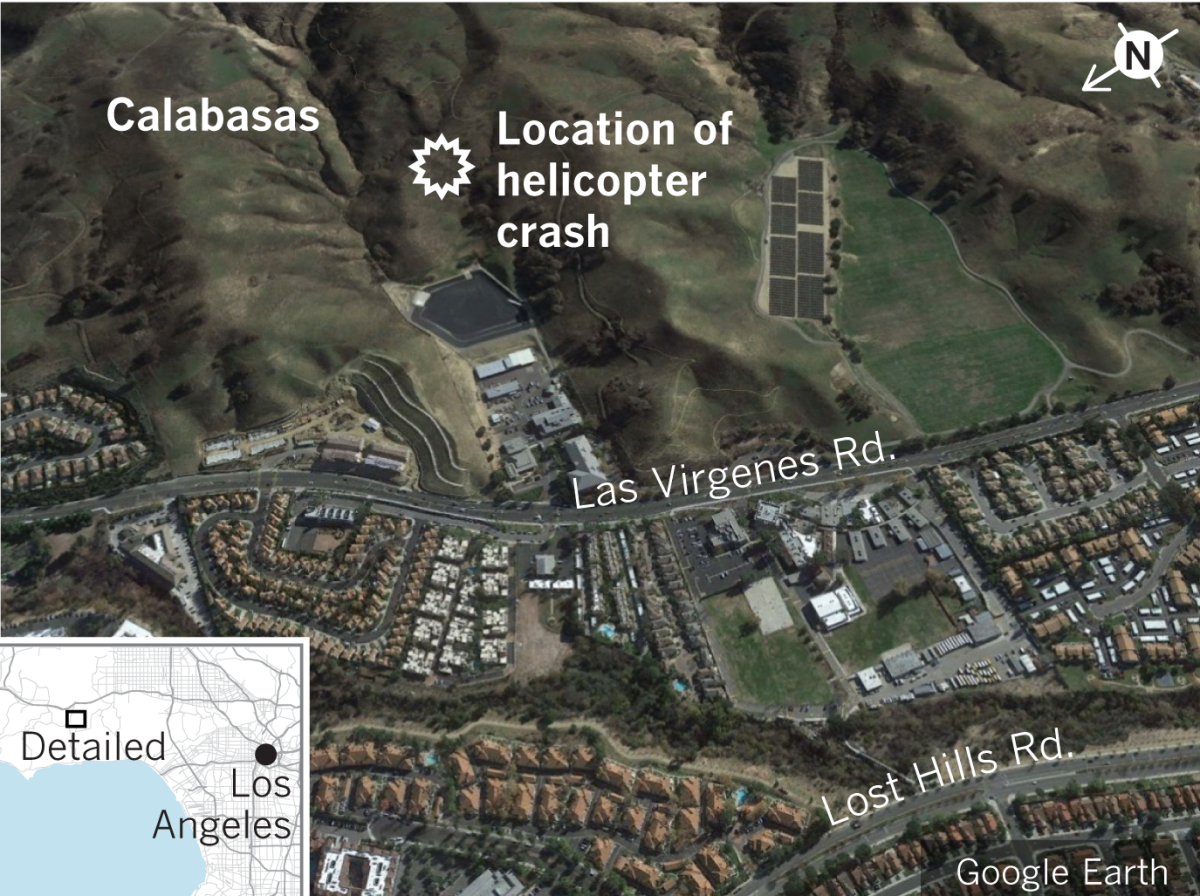
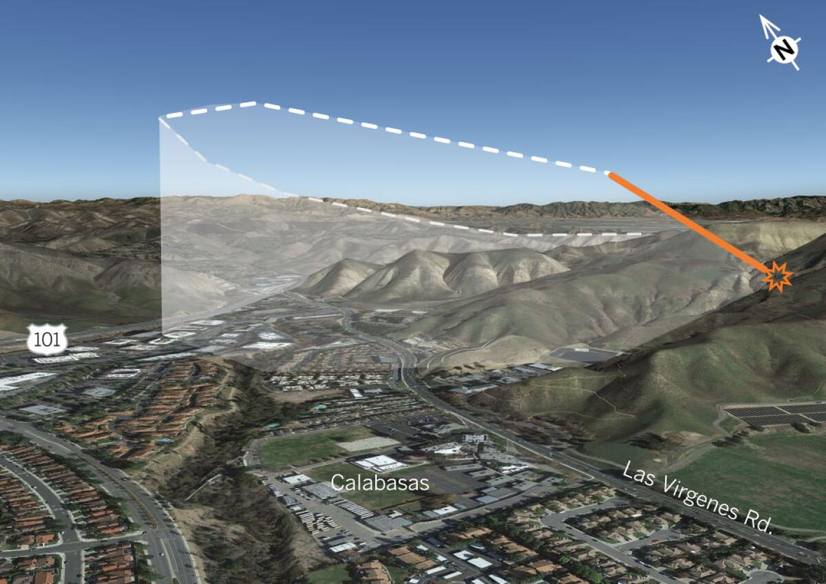
Officials said the chopper, which was flying using only visual readings, slammed into a hillside amid extremely foggy conditions. A Times data analysis tracked the final moments of the flight, finding the helicopter flew dangerously close to another hillside just before crashing.
What we know
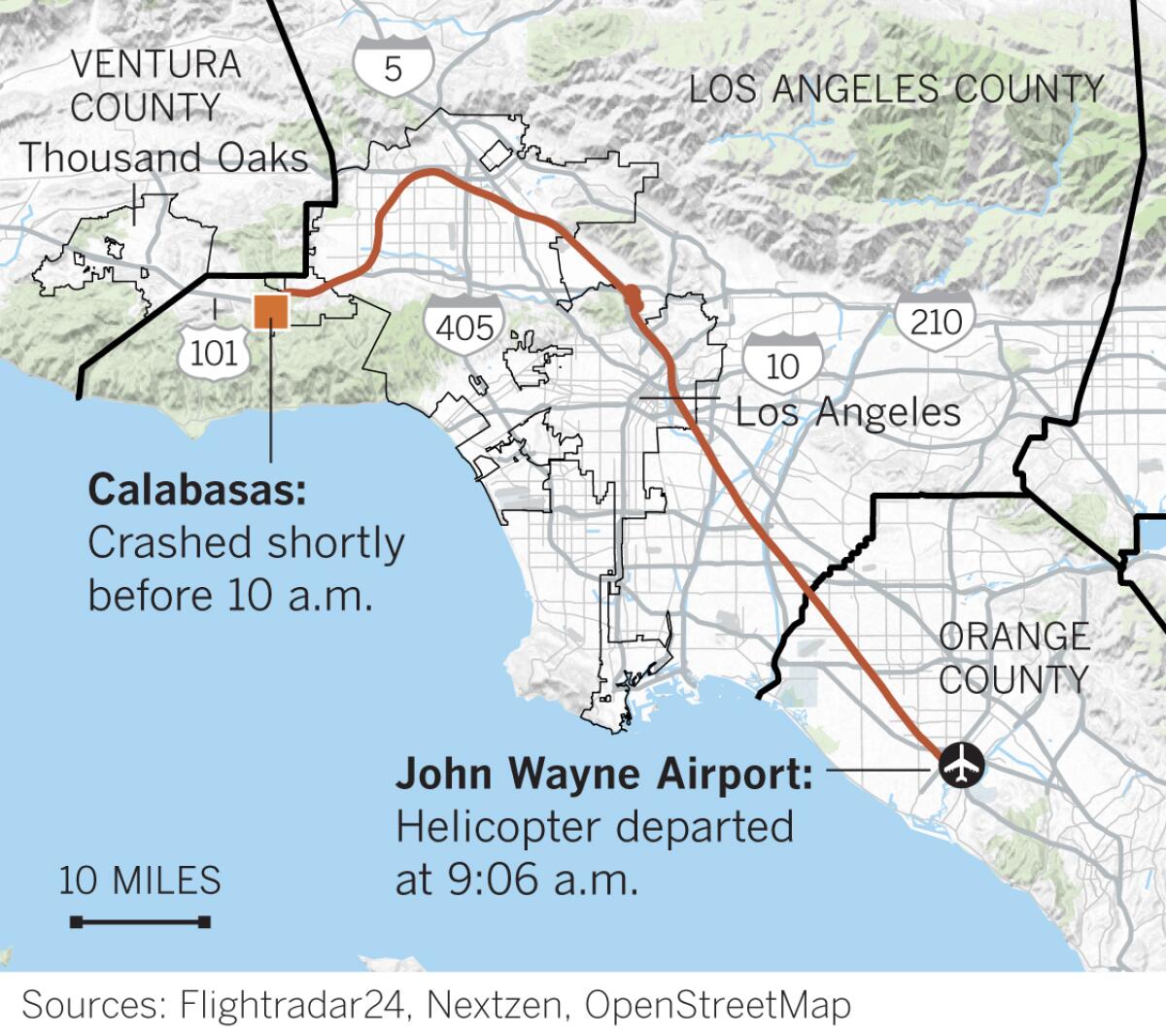
WEATHER ISSUES: The helicopter — a Sikorsky S-76 chopper built in 1991 — departed John Wayne Airport in Orange County at 9:06 a.m. Jan. 26, according to publicly available flight records. The aircraft passed over Boyle Heights, near Dodger Stadium and circled over Glendale during the flight.

The pilot, Ara Zobayan, requested special visual flight rules, or VFR, which allow pilots to fly in controlled airspace when ceilings are less than 1,000 feet or when visibility is less than three miles. As weather conditions deteriorated on the trip to Ventura County, the pilot requested “flight following,” a process in which controllers are in regular contact with an aircraft and can help navigate.
In recorded radio communications, the air traffic control tower is heard telling the pilot the chopper is too low for flight following. Radar data indicate Zobayan, who had been a licensed commercial helicopter pilot for 19 years, guided the copter to 2,300 feet and then began a left turn.
SUDDEN DESCENT: NTSB board member Jennifer Homendy said last week the helicopter, which lacked a terrain warning system, was at 2,300 feet when it lost communication with air traffic controllers. The helicopter was descending at more than 2,000 feet per minute at the time of impact.

The chopper hit the hillside at an elevation of 1,085 feet, about 20 to 30 feet below an outcropping. Even if the pilot had been able to fly above the hilltop, he would have faced new hazards, officials said.
“There are actually other higher hills surrounding it,” said Bill English, a lead investigator.
What we don’t know
- Officials have not indicated any cause for the crash itself. Investigators said last week they were examining possibilities that included weather, mechanical issues and pilot actions.
- It appears the pilot had lost contact with air traffic control at the very end, according to radio recordings reviewed by The Times, but it’s unclear why.
- Though the last moments of the flight are captured on flight trackers, the reason the pilot made the fateful series of moves is unclear.

- The NTSB has said the chopper was not equipped with a terrain alarm system that could have warned the pilot he was approaching a hillside. The agency had recommended 16 years ago that the Federal Aviation Administration require all helicopters carrying six or more passengers be equipped with the device. But the recommendation was not implemented, so the chopper wasn’t required to have the system. Would it have made a difference?
More to Read
Sign up for Essential California
The most important California stories and recommendations in your inbox every morning.
You may occasionally receive promotional content from the Los Angeles Times.


