After this week’s near-record heat, California will return to cooler weather in mid-May

- Share via
After a summer-like pattern of high pressure and offshore flow prevailing through at least Thursday in Southern California, much cooler conditions and a thicker marine layer will begin to return Friday and over the weekend into early next week, the National Weather Service said.
In Northern California, a robust cooling trend could be accompanied by light rain, and light showers and drizzle are possible along the Central Coast next week.
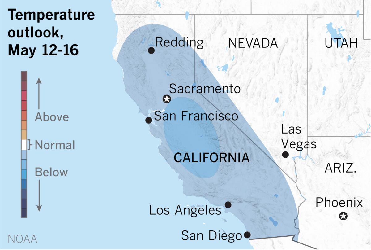
The temperature outlook produced by the National Oceanic and Atmospheric Administration for May 12-16 calls for below-normal temperatures for most of California, while much of the surrounding western U.S. is about normal.

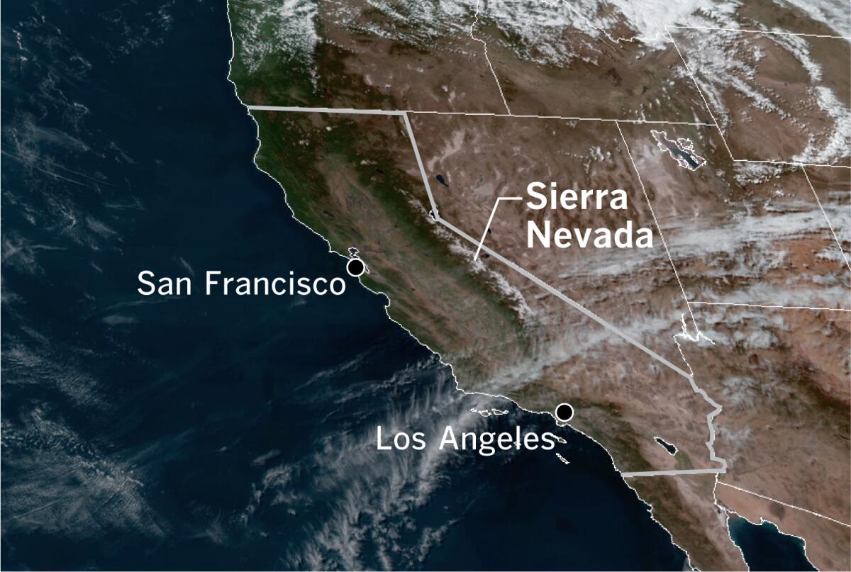
A strong upper-level ridge of high pressure over all of California kept skies clear on Wednesday afternoon. A few high clouds could be seen streaming across the Central Coast in a satellite photo, and the snow-capped Sierra Nevada were easily visible.
An upper-level trough that was in the north Pacific Wednesday will move east to the California coast by Monday evening, bringing an increase in onshore flow with low clouds and fog pushing into the valleys each night and morning.
While this may be the last cooler and wetter interlude of the season in Northern California, as UCLA climate scientist Daniel Swain points out, it may help to temporarily tamp down the presently above-average wildfire risk.
More to Read
Sign up for Essential California
The most important California stories and recommendations in your inbox every morning.
You may occasionally receive promotional content from the Los Angeles Times.


