An unusual spring draws to a close on a somewhat normal June-gloom note
- Share via
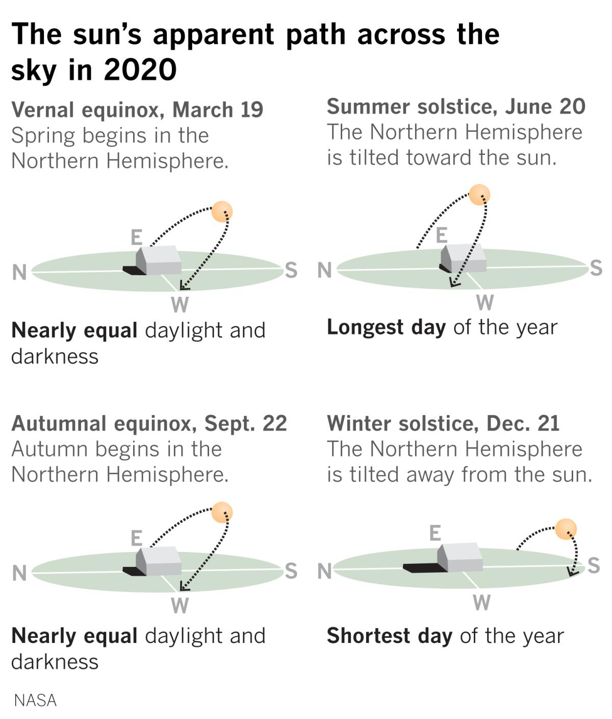
A spring that has been unusual on so many levels will finally turn into summer — officially — on Saturday afternoon. This is the summer solstice in the Northern Hemisphere, when the sun appears at its highest point in the noontime sky.
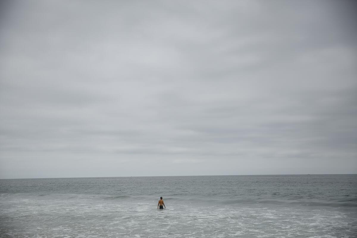
The cool May gray and June gloom conditions that usually precede the hot dog days of summer were mostly absent this year, and temperatures in Los Angeles were above normal in May and June.
“The last few days of extensive marine layer have felt more typical for this time of the year compared to most days this month,” said Eric Boldt, a meteorologist with the National Weather Service in Oxnard.
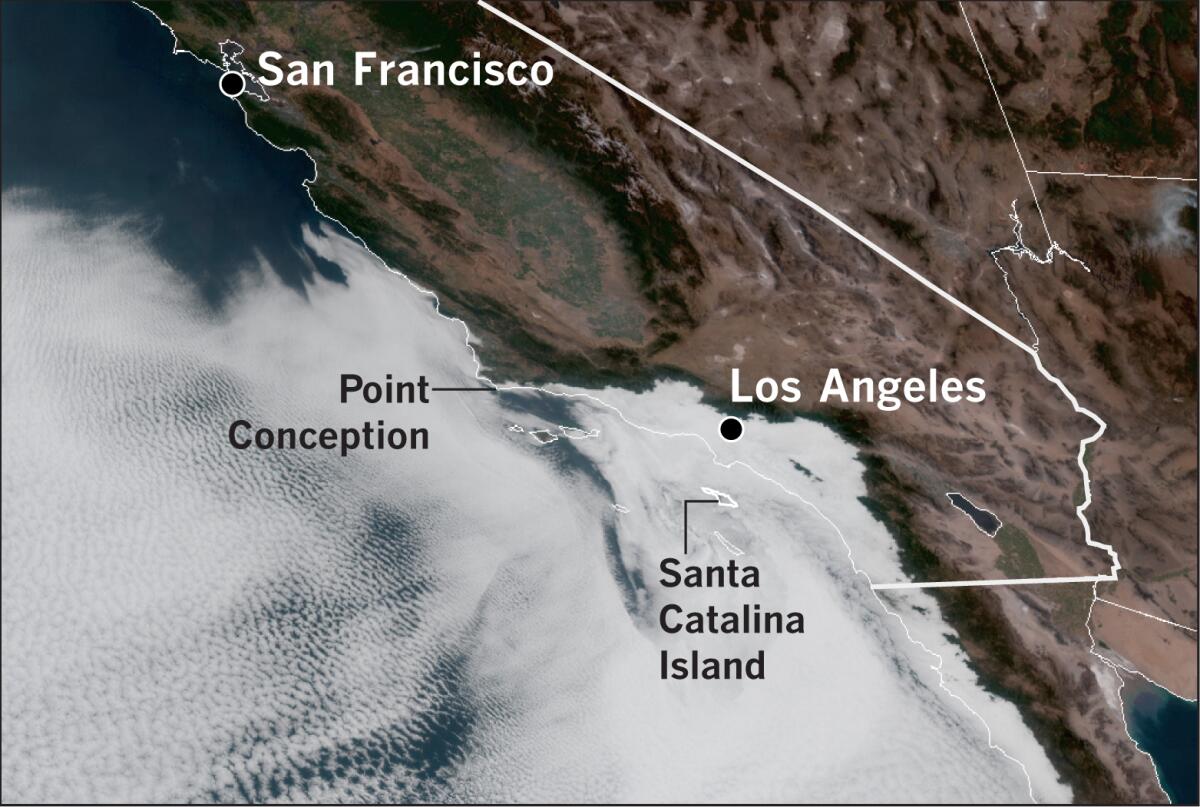
A satellite photo taken this morning shows how extensive the marine layer was. In the picture, low clouds and fog are seen reaching inland from the coast as far as the Cajon and San Gorgonio passes. The Santa Ana Mountains between Orange and Riverside counties are seen poking through the cottony white shroud. Clouds extend to Santa Clarita and out toward the High Desert, and along the coast westward beyond Santa Barbara to Point Conception.
A satellite loop showed circulation around a point west of Santa Catalina Island and northwest of San Clemente Island. These are the telltale markers of a Catalina eddy, a counterclockwise spin that is a byproduct of west to northwest winds along the California Coast.
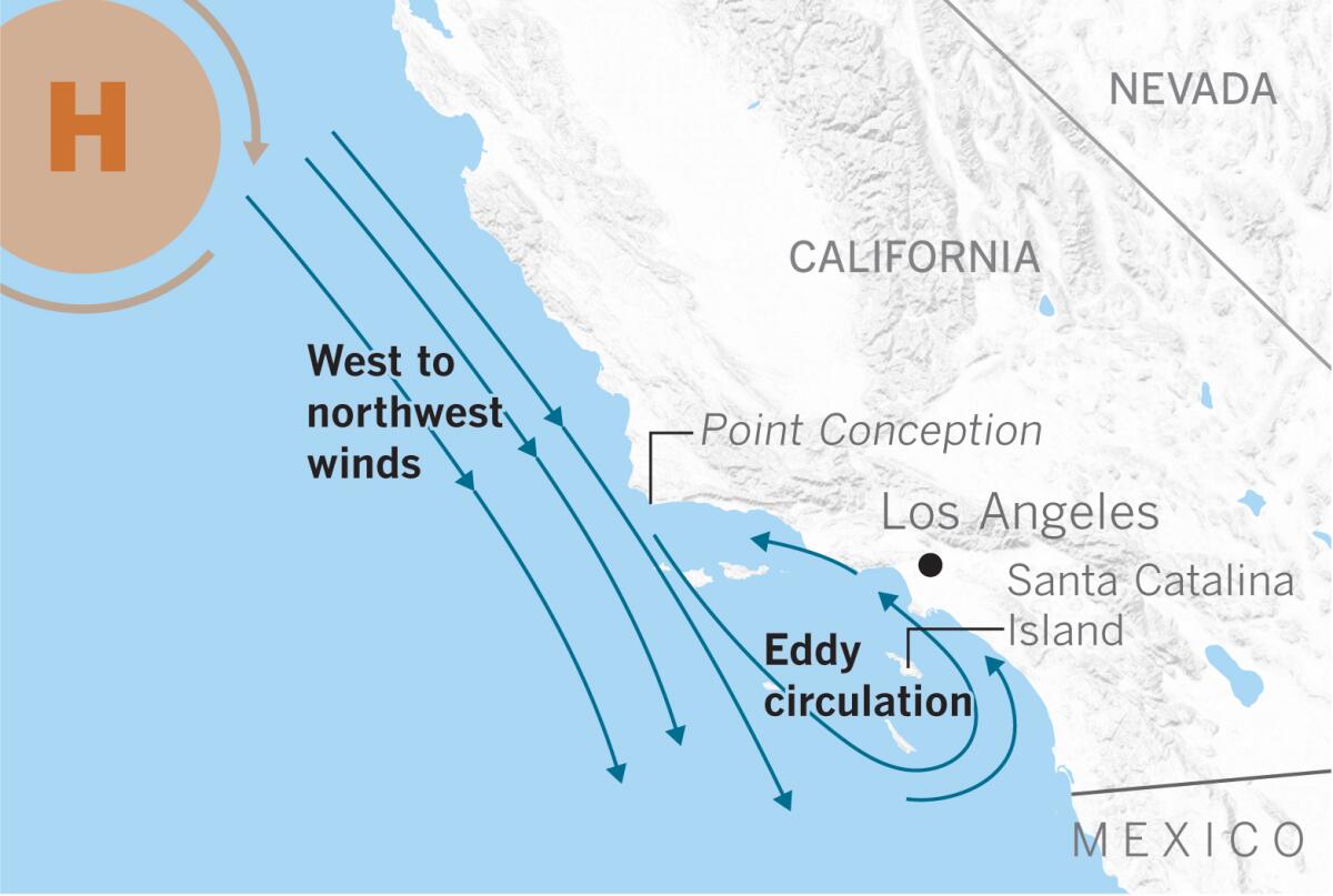
The winds interact with the coastal topography as they pass Point Conception, behaving much as water does on the downstream side of rocks or obstructions in a river. The winds turn inland in the Southern California Bight, the curvature of the coast from Point Conception to the Mexican Border, and spin clouds and fog ashore into Los Angeles.
More such eddy circulation is likely each morning through this weekend, the National Weather Service said.
“During the hot, dry summer months, the winds are welcome because they carry the marine layer onshore, blanketing and cooling the Los Angeles Basin,” explains climatologist Bill Patzert.
June is the peak season for the Catalina eddy, also called a coastal eddy. But this May and June, high pressure along with offshore winds — warm winds blowing from the land toward the ocean — dominated, making a spring that was unusually sunny and warm. There even were rare, late-season Santa Ana winds this month.
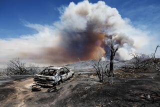
“Santa Anas in early June are not a good omen for this summer. The fire season could pop up on us any time now,” Patzert said.
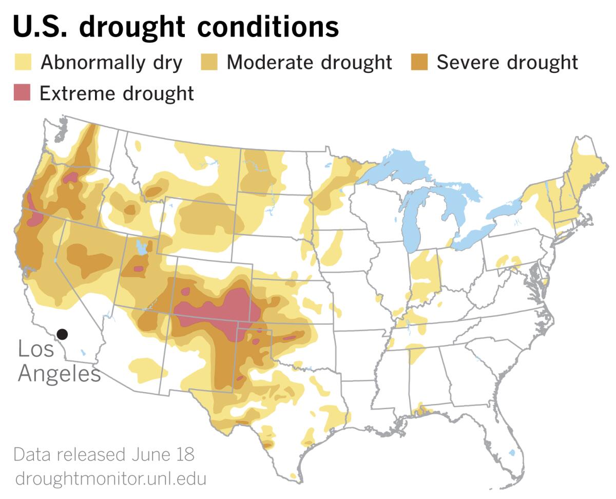
Fuels throughout the West are dry. The U.S. Drought Monitor data released Thursday shows that widespread drought conditions in the West continue to be a reflection of unusually warm spring temperatures. Although some parts of the West received precipitation, areas west and north of the Four Corners saw little or no rain. And warmer-than-normal temperatures from a couple of degrees to as much as 10 degrees exacerbated conditions in the areas that remained dry, according to the Drought Monitor.
The northern half of California and large portions of the Great Basin and Pacific Northwest are deemed to be in moderate to severe drought.
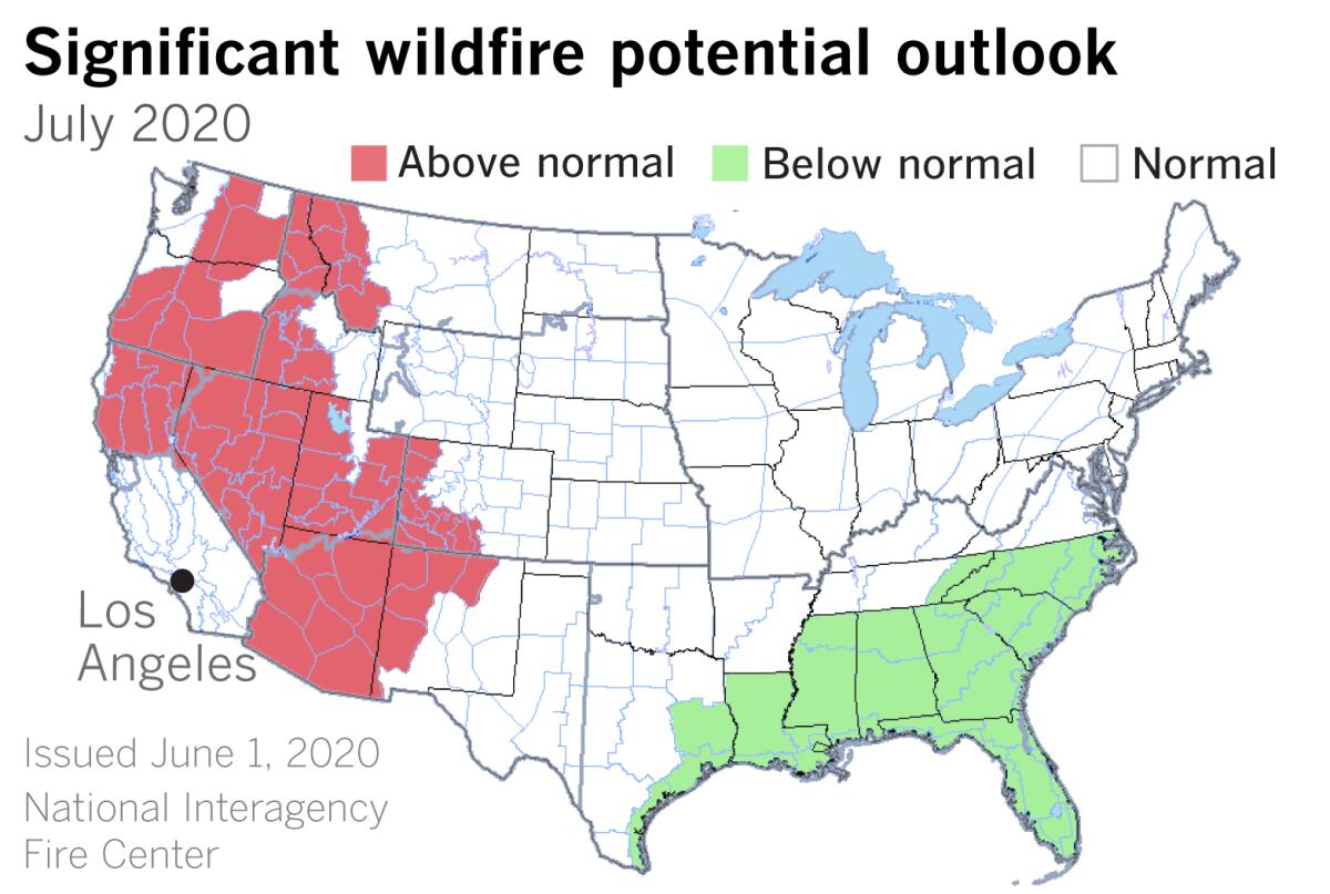
Potential for significant large fires is expected to be above normal throughout much of the West in July, according to the National Interagency Fire Center, primarily because of increasing drought conditions, early melting of mountain snowpacks, lightning strikes and the hot and dry conditions that are expected to persist through August.
In the outlooks for July and August, lightning is viewed as a primary trigger. Then in September the increasing threat of dry offshore winds takes precedence. Regardless of the trigger, dry fuels are expected to keep the potential for significant large fires above normal through the summer season and well into September.
More to Read
Sign up for Essential California
The most important California stories and recommendations in your inbox every morning.
You may occasionally receive promotional content from the Los Angeles Times.

