California heat wave may rival deadly July 2006 event, forecasters say
- Share via
The heat wave that began Friday in California may rival the deadly seven-day heat event of July 2006, the National Weather Service said.
The valleys, mountains and deserts of Southern California are likely to see daytime and nighttime temperatures challenge records through at least Thursday, and humidity will make conditions feel 2 to 5 degrees warmer during the day.
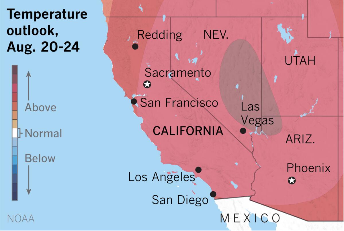
Extended outlooks prepared by the National Oceanic and Atmospheric Administration favor above-normal temperatures persisting well beyond Thursday.
The excessive heat is the result of a large, strong high-pressure system centered over Arizona, which is keeping the Southwestern U.S. hot almost everywhere except within a few miles of the coast.
High pressure over southwestern California on Tuesday will reach a strength that occurs only about once every 10 years, said Eric Boldt, a meteorologist with the National Weather Service in Oxnard. This dome of high-pressure air blocks storm systems and creates the building heat over the Southwest.
It was during the deadly 2006 heat wave that Los Angeles County recorded its all-time highest temperature: 119 degrees in Woodland Hills on July 22.
The Times reported that coroners in Los Angeles, San Bernardino and Kern counties connected about 130 deaths to the heat, with diagnoses including hyperthermia and heatstroke. But state researchers later estimated that the toll in those counties was more likely in the range of 350 to 450.
This time around, California plunges into the statewide heat wave with the ongoing COVID-19 pandemic as a sort of preexisitng condition.
The National Weather Service warned Friday of the very real potential for heat stress and heatstroke with the current heat wave.
Valleys in the Los Angeles region can expect highs of 100 to 108 degrees, with lows of 72 to 82. Elevations below 5,000 feet will see highs of 98 to 105 and lows of 65 to 75. High temperatures will be 102 to 112 in the Antelope Valley, with lows from 70 to 80. Coastal areas can look for highs of 82 to 92 and lows of 65 to 70.
Critical heat will occur between the hours of 11 a.m. and 7 p.m. daily, especially inland, the weather service said. Nighttime temperatures won’t cool enough to provide comfortable sleeping weather in many places.
Brief elevated to critical fire weather conditions will exist daily during the period, with concerns for the possibility of new fire starts from isolated dry lightning strikes. Plume-dominated fires may lead to rapid fire spread and locally unpredictable winds.
There’s a chance of thunderstorms Saturday, and again Sunday through Tuesday, when monsoon moisture is expected to return. Even if it doesn’t rain where you are, the humidity will probably make for the kind of unpleasantly muggy conditions with which Californians are largely unfamiliar. Heavy rain and flash flooding could accompany any thunderstorm activity.
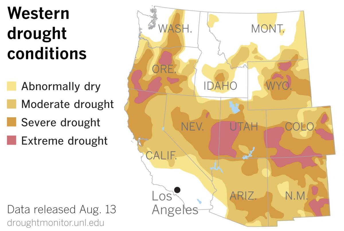
Monsoonal rains in the Southwest have continued to be disappointingly spotty at best, according to the most recent U.S. Drought Monitor report, released Thursday. Some parts of the Southwest expect to get half of their precipitation during the North American monsoon. Parts of Arizona and New Mexico endured temperatures that were 3 to 5 degrees above normal during the last week.
Although California’s drought conditions remained about the same, extreme drought in the West expanded by nearly 1.4%. Areas of the West deemed to be in moderate drought grew by 1.3%, and areas of severe drought increased by almost 1%, according to data from the U.S. Drought Monitor.
More to Read
Sign up for Essential California
The most important California stories and recommendations in your inbox every morning.
You may occasionally receive promotional content from the Los Angeles Times.
