Some California cities think they’re safe from sea level rise. They’re not, new data show
- Share via
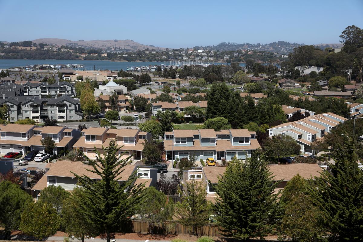
Just north of the Golden Gate Bridge, yet a world away from San Francisco, in an unincorporated and oft-overlooked area known as Marin City, sea level rise is rarely the first worry that comes to mind.
Traditional flood maps for this predominantly Black and working-class community suggest that the area is safe until sea level rise reaches 3 feet or more.
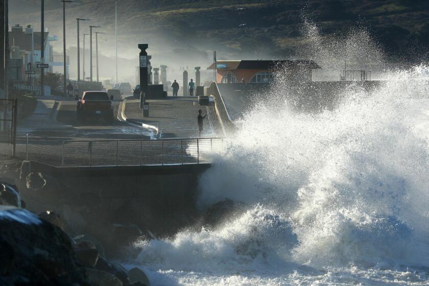
But sea level rise is a lot more complicated than just waves breaking over seawalls and beaches disappearing.
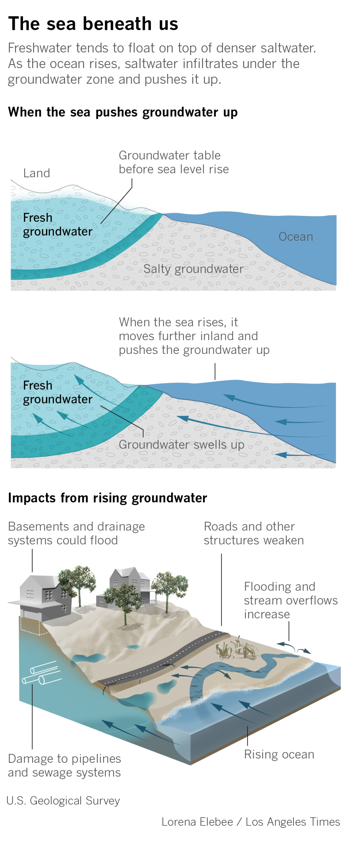
Imagine the groundwater beneath your feet. As the ocean moves inland, it will push all this trapped water upward until it breaks the surface. Basements will heave, brackish water could corrode sewer pipes, toxic contaminants buried in the soil could bubble up and spread.
In many areas along San Francisco Bay, this sea beneath us is already leaking out of the ground, said Kristina Hill, whose research at UC Berkeley focuses on this less-talked-about vulnerability. With even 1 foot more of sea rise, an unexpected swath of Marin City could increasingly flood.
Aside from homes and roads, human health is also a huge concern, she said. “Any pollution in the soil, capped from above but lying just below, will be re-mobilized.”
From Northern to Southern California, scientists and planners are waking up to the reality that rising seas will threaten not only California’s precious shoreline but also areas once considered less vulnerable to flooding. In the Bay Area alone, Hill and her team found that more than twice as much land could flood from groundwater as the ocean rises.
Little data exist to help map the problem. Another research team at the U.S. Geological Survey has spent years piecing information together for the first time for the entire state — identifying particularly problematic areas and figuring out more refined ways to study this emerging issue.
“We can build protections, walls, berms to prevent overland flooding, but that’s not going to stop the groundwater,” said Patrick Barnard, research director of the USGS Climate Impacts and Coastal Processes Team and coauthor of a study published Monday in the journal Nature Climate Change. “It’s this slow creep upward that gets into garages and foundations and roadbeds.”
Seawater has also increasingly pushed into rivers and deeper aquifers, burdening communities that rely on groundwater. Wells are going salty for coastal farmers in the Salinas Valley. So is a crucial water supply under the Oxnard Plain. In Los Angeles County, water officials have fought for decades against the sea’s silent march underground.
These compounding problems come at a time when more officials across California are starting to confront the social, economic and environmental catastrophe looming over the shore. In a stark report last week, the Legislative Analyst’s Office urged state lawmakers to remember that while this issue may seem less pressing compared with the COVID-19 pandemic, “the state and its coastal communities cannot afford to defer all preparation efforts until economic conditions have fully rebounded from the recent crisis.”
At least $8 billion in property could be underwater by 2050, with an additional $10 billion at risk during high tides. In just the next decade, the sea could rise more than half a foot — with heavy storms and cycles of El Niño projected to make things even worse.
At a meeting held earlier this year by a special committee of state lawmakers who had started to revive these much-needed discussions on sea level rise, Assemblyman Kevin Mullin (D-San Mateo), who serves as speaker pro tem, didn’t mince words:
“I’m feeling the urgency,” he said, “and blown away, frankly, by the magnitude of the challenge that we have in front of us.”
As for Hill, who teaches environmental planning, she’s worried about overlooked communities like Marin City and historically industrial areas like East Oakland, where much of the soil is contaminated.
When talking about groundwater, there are two types to consider: One, the kind Hill studies, is the unconfined water that gathers in the pore spaces of soil very close to the surface. It’s the water that runs off streets and soaks into the ground. The other type, confined in aquifers many hundreds of feet deep, is the water that we tap for drinking.
When the sea moves inland, the shallow fresh water tends to float on top of the denser salt water — and gets pushed upward toward the surface as ocean levels rise. Because the shallow groundwater is not for drinking, however, few people have studied or understand this layer of water in California.
Analyzing data from 10,000 wells across the San Francisco Bay Area, Hill and her team mapped for the first time the region’s shallow groundwater. She homed in on Marin City, which was a straightforward example of an issue that quickly gets complicated.
The topography here is shaped like a bowl, she said, which makes it relatively simple to project where the emerging groundwater would flood (the bottom of the bowl). Much of the area was also built on filled-in wetlands, where water naturally wants to go.
Hill noted that these first approximation maps laid the groundwork for more complex scientific analyses.
Kevin Befus, a hydrologist who in 2016 modeled shallow groundwater along the entire East Coast for the USGS, has spent the last few years sorting through all the available data across California’s more than 1,200-mile shoreline — analyzing and refining until he was able to create a statewide model that identified critical data gaps and areas particularly vulnerable to groundwater problems.
Using high-resolution topography data, he studied the physics of how the groundwater would drain or flood depending on the terrain and any nearby creeks or rivers. He found that about 30% of California’s coast had groundwater conditions similar to conditions in the cities Hill has been studying in the Bay Area.
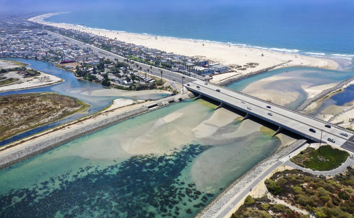
Developed areas, especially along river plains and lagoons or on top of filled-in wetlands, face increasing threats underground. Venice and other low-lying stretches from Long Beach down toward San Diego — all these areas have infrastructure that could be impacted as the groundwater rises with the sea. In one section of Huntington Beach, areas farther inland that do not show up in traditional flood maps could be flooded by groundwater lurking just a few feet below ground.
Airports are also particularly vulnerable. Many are built on flat, low-elevation areas by the water, researchers noted, with grading that has filled in natural drainage features. Ports and Navy infrastructure in Ventura and Los Angeles counties also need to consider groundwater impacts when planning for sea level rise.
Add rain on top of all this, Befus said, and any drainage system could quickly get overwhelmed. In Honolulu, where groundwater is already impacting buried infrastructure, a high tide can back up storm drains and wastewater pipes so much that residents sometimes wake up to dirty flooded roads on a sunny day.
How to defend against this kind of flooding is tricky — spending millions of dollars on higher seawalls and levees would not stop flooding on the inland side as the groundwater equalizes with sea level. Pumping the groundwater is also costly and could cause the land itself to sink to lower elevations — allowing more flooding from the rising ocean.
Where President Trump and Joe Biden stand on immigration policy, including DACA, refugees, asylum seekers, pathways to citizenship and deportations.
“It comes down to a value: What do people value, what do they want to protect? What are they OK with giving up on?” said Befus, now an assistant professor of geosciences at the University of Arkansas and lead author of Monday’s study. “Water has a way of finding the lowest spot — we can pump it out, but at some point, when is that not financially feasible anymore?”
Befus and the USGS are working to make the model more complex — perhaps adding storms or analyzing how much valuable infrastructure is at stake. City and county leaders, in the meantime, could also do more site-specific studies to figure out areas that should be more closely monitored.
The San Francisco Bay Conservation and Development Commission is working on implementing groundwater into its sea level rise maps, and cities including Alameda and Hayward have started their own plans. Marin City, officials also noted, is in the process of assessing vulnerabilities, and environmental groups are helping the community restore wetlands that could help mitigate future flooding.
As for our drinking water deeper underground, saltwater intrusion has called for costly and elaborate measures.
In Los Angeles County, water officials for decades have operated hundreds of “barrier wells,” stretching from Los Angeles International Airport to the Palos Verdes Hills — a system that injects fresh water more than 200 feet deep to prevent any salt water from moving in.
Salty groundwater was detected more than a century ago, and rampant pumping as population grew led to an overdraft that allowed the sea to contaminate 600,000 acre-feet of fresh water — water that could have supplied 4.8 million people in L.A. for a year. The aquifer today supplies about half of the water needed for 43 cities in Los Angeles County — and remains significantly below sea level.
“These wells are running nonstop, 24 hours a day, seven days a week,” said Ted Johnson, assistant general manager of the Water Replenishment District of Southern California, a voter-initiated agency created in the 1950s to save the region’s groundwater. “They have to be balanced all the time for the right amount of water.”
A few inches of sea level rise can easily be factored into existing monitoring and calculations, Johnson said, but increasing costs and finite supplies are front of mind. Officials have been finding ways to inject the aquifer with recycled water, rather than importing large amounts from other regions that also increasingly need fresh water.
Mark Gold, the governor’s deputy secretary for coast and ocean policy, said that seawater pushing into both deep and shallow groundwater is a threat that California cannot ignore. In a set of targets guided by Gov. Gavin Newsom’s administration, many agencies recently agreed to prepare California for at least 3.5 feet of sea level rise by 2050.
Gold has been working with these agencies to better understand which roads, rail lines and other coastal infrastructure are most at risk to rising seas. But when it comes to sewage pipes, pump stations and other infrastructure underground, it’s not easy knowing where to start. The information that scientists are now piecing together, he said, is crucial.
“What you don’t see,” he said, “can be as devastating as what you do see.”
More to Read
Sign up for Essential California
The most important California stories and recommendations in your inbox every morning.
You may occasionally receive promotional content from the Los Angeles Times.
