Burned by wildfire, Northern California towns now fear flooding and toxic runoff from storm

- Share via
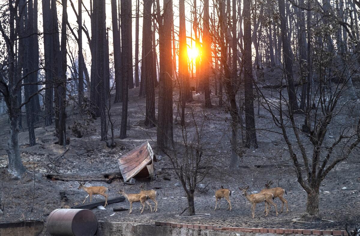
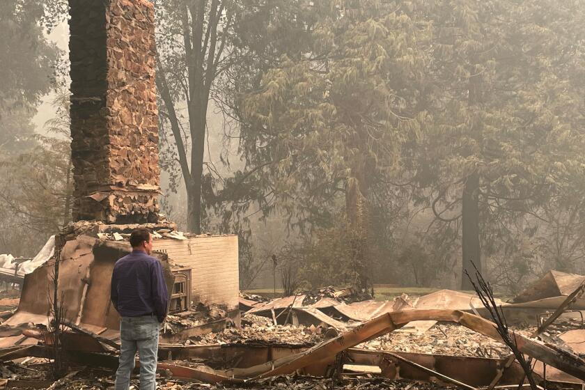
SACRAMENTO — In the burned-out town of Greenville, deep on a Plumas County mountainside, the storms now battering Northern California are another trauma in a year of heartbreak.
“Be careful what you wish for,” Plumas County Supervisor Kevin Goss said Thursday, just off a briefing with state emergency response officials. Torrential rainfall is expected to soften the state’s drought this weekend, but the rain also brings the risk of debris flows and floods in places hit by wildfires.
“We are going to have some problems,” Goss said. “It was inevitable for this to happen this way. But we will deal with it. We are strong and resilient.”
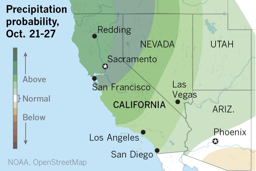
A large trough of low pressure hovering off the coast of the Pacific Northwest is driving repeated rounds of precipitation in the northern part of California. It ushered in the first major storm of the season Thursday, National Weather Service forecasters said, along with fears that places already hit by the disaster of flames may now be primed for the destruction of downpours.
The storms come after officials announced California’s driest year in a century, but the whipsaw conditions are not totally surprising. Scientists have long warned that climate change could hit the West with quick shifts from dry to wet, and visa versa.
The National Weather Service in Reno has issued a flash-flood watch for a portion of northeast California through Friday morning around the Dixie, Sheep, Walker and Beckwourth burn scars. Another storm expected to move in hours after that is lifted — the worst rains are expected on Sunday, when places like Plumas may see up to 10 inches in a 24-hour period.
What’s known as an “atmospheric river” is pumping continuous moisture over the region, said Ryan Kittell, a meteorologist with the weather service’s Oxnard station, and could lead to a “bomb cyclone,” a heavy, moisture-laden weather pattern characterized by a quick, significant drop in barometric pressure. Also called bombogenesis, it’s a weather event familiar in nor’easter storms on the East Coast and prone to happen this time of year.
The storm is expected to be a Category 5 — the highest level on a scale based on strength and duration, said Marty Ralph, director of the Center for Western Weather and Water Extremes at Scripps Institution of Oceanography, a department of UC San Diego. Ralph is the leader of the team that developed the rating system.
Goss said that beyond concerns to life and property, officials are also worried about contamination of the state’s drinking water from toxic runoff. With fires only recently contained in many areas, there hasn’t been enough time to clear burned homes and businesses, where the ash can be filled with pollutants. Runoff from those sites could reach the Feather River, which flows through the Dixie burn scar, and feeds the Oroville Dam east of Sacramento, where more than a trillion gallons of water can be stored.
Similar concerns have been raised for the waterways that feed Lake Tahoe.
Late October precipitation could dampen wildfires in Northern California
Brian Ferguson, spokesman for California’s Office of Emergency Services, said crews have been busy fortifying protections for the Feather River and other tributaries since partial containment of the fire allowed that restoration work. Those efforts have included building barriers along streams and rivers, repairing and constructing retaining walls and creating temporary measures such as fencing over unstable hillsides to prevent slides.
For the record:
9:56 a.m. Oct. 22, 2021An earlier version of this article indicated Donner Summit is on Highway 50. It is near Interstate 80.
Ferguson said state authorities have also positioned deep-water rescue vehicles in high-risk areas, and they have put crews on top of Interstate 80’s Donner Summit in case of road closures.
The Caldor fire burned in forests alongside that two-lane mountain highway in a miles-long stretch from the foothills to Tahoe, leaving hundreds of dead trees that could topple in wind and rain. There are also stretches of steep hillsides where slides were already a problem, and where fire crews have had little chance to complete mitigation work with the blaze contained only weeks ago.
“That is a fresher burn, and it happened later in the season than Dixie fire,” Ferguson said.
He said crews working on that burn scar have been concentrating on higher elevations, hoping to make progress before snow shuts down operations for the winter — leaving lower elevations still at risk.
Michael Davis, public information officer with the Great Basin Area Type One Incident Command Team in charge of the Dixie fire, said the team produced a more hopeful analysis for the Plumas area, finding no specific places where the threat of a slide was concerning.
He said the Dixie fire command team is not engaged in any weather-specific work but is continuing with planned cleanup and containment, hoping, like Caldor crews, to handle some of the worst areas before winter.
State and local officials have also provided residents with sandbags and other flood-prevention materials for their private property. Ferguson said that the state is encouraging home owners to check their insurance policies. He said that as home values have skyrocketed in recent years, many homeowners have failed to up their coverage to the current price tags — potentially leaving them underinsured.
“We are telling people that they need to be checking their coverage,” he said.
Plumas County Supervisor Kevin Goss came back to his hometown Friday for the first time since evacuating from the path of the Dixie fire. He was not fully prepared for what he saw.
Goss said in Quincy, the county seat of Plumas, gas stations were doing brisk business and grocery stores were packed with customers. In an area where rock slides can close roads for weeks even in the best of circumstances, he said, residents were prepping to be cut off from supplies.
“I’ve seen floods here that have just washed out whole highways,” he said. “And there’s not much we can do to mitigate it.”
The concern spread as far south as Santa Cruz. Though fires did not reach those mountainous forests this year, they are still recovering from last year’s blazes.
Mark Bingham, chief of the Boulder Creek Fire Protection District, said he’s closely watching the situation, and actively working with his department to make sure communication and logistics are ready to go should the situation “go south.”
“We’ve been continuing all year to refine our communications and response plans … and prepare our responders with the new gear and skill sets” for mudslides and debris flows that they acquired after the 2020 fires.
“We don’t want to cause a sky-is-falling ‘Chicken Little’ syndrome,” he said. “But we’re on that teetering edge, where if we wait too long, then we’ll also have people screaming they didn’t get enough warning.”
And that can cause danger, too, if people don’t have the time to get out, he said.
Nate Armstrong, a deputy chief with the California Department of Forestry and Fire Protection, said fire crews completed the bulk of prep work last fall, in anticipation of winter rains that never materialized.
California gets enormous floods roughly once a decade, says geologist Jeff Mount. He says that now is the time to prepare.
“We’re now just monitoring,” Armstrong said. He noted that Cal Fire, county officials and sheriff’s departments from Santa Cruz and San Mateo counties have talked on a call and will have anotheras the storm moves.
“It’s very early in the season, and we want to make sure that before we issue any evacuation warnings or orders, there is a high probability of something going to happen,” he said. “We don’t want people getting evacuation fatigue.”
“Having said that,” he added, “we also want to make that call as soon as possible” so that people have time to get out. He said a warning would come 48 hours before the predicted event, and an order 24 hours before.
Although the bulk of the rain will be to the north, the storm system will also drift into Southern California. Weather officials predict metros areas in Los Angeles County could get about a half-inch of rain, and 1 to 1 ½ inches in the mountains.
Concerns are lower in Southern California, where some burn scars are older, and therefore less prone to slides and flooding, weather officials said.
But officials are “moderately concerned” about the area charred by the recent Alisal fire in western Santa Barbara County, which ignited Oct. 11.
“It’s really fresh,” said Kittell, the meteorologist. “There’s a few vulnerable areas that any kind of mud and debris flows would cause some issues.”
More to Read
Sign up for Essential California
The most important California stories and recommendations in your inbox every morning.
You may occasionally receive promotional content from the Los Angeles Times.


