Wet weather heading to Southern California: What to expect this holiday weekend

- Share via
A slow-moving winter storm pounding Northern California with rain and snow is making its way south, promising to deliver a wet holiday weekend for Los Angeles.
Rain is slated to develop over northern San Luis Obispo County and Santa Barbara County on Wednesday but likely won’t slide into Los Angeles County until Thursday, the National Weather Service said.
At that point, the dry, cloudy conditions that have lingered all week will be replaced by a prolonged period of “wet and unsettled weather.”
By Thursday afternoon, “it should be raining everywhere,” forecasters said, although models are not yet in agreement about the storm’s precise timing or rainfall totals.
“There’s a lot of different pieces to it, and the track it’s taking is not traditional,” said Mike Wofford, a meteorologist with the weather service’s Oxnard office, noting that the storm is positioned to the west and pulling in moisture from the south.
“A lot of ingredients have to come together, and that just makes it tricky in the timing and how much is going to fall,” he said.
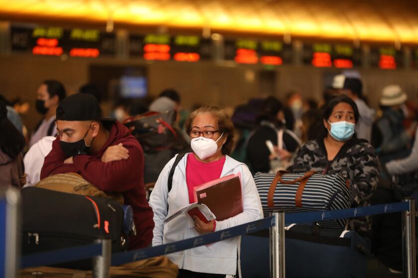
If you’re traveling by plane this holiday season, here are tips for reducing your COVID-19 risk as much as possible at the airport and on your flights.
Forecasts indicate that L.A. residents will see periods of moderate to heavy rain beginning Thursday, bringing the potential for snarled holiday travel and hazardous delays.
Flood watches have been issued in several Southern California areas — including portions of San Bernardino, Riverside, San Diego and Orange counties — from Thursday evening through Friday morning. Excessive runoff could result in the flooding of rivers, creeks, streams and other low-lying locations, forecasters warned.
Minor mud and debris flow could occur in and around recent burn scars, including those from the Bond, Apple and El Dorado fires. Residents are advised to be cautious while driving on slick or icy roads.
Authorities in Orange County issued a voluntary evacuation warning beginning at 8 a.m. Thursday for Silverado Canyon, Williams Canyon and Modjeska in the Bond fire burn area. Officials said the warning is expected to stay in place through noon Friday.
Canyon roads will be open to residents only when the warning takes effect, authorities said.
Library of the Canyons will also be closed Thursday, authorities said.
The evacuation warning comes alongside a weather service flash flood watch in place from 7 p.m. Thursday through noon Friday.
Residents in the voluntary evacuation areas are encouraged to leave early and make arrangements to shelter outside of the area, officials said.
People with disabilities and others needing help evacuating should call Orange County Sheriff’s Department dispatch at (714) 647-7000. People with pets or who have large animals should call Orange County Animal Care at (714) 935-6848 if they have questions or need assistance.
Anyone needing to report storm-related issues with a county road or flood control channel should call the O.C. Public Works Storm Center at (714) 955-0200 during normal business hours, or at (714) 955-0333 during flash flood events and other emergencies.
County social services and the American Red Cross plan to set up an information center and shelter to help evacuees if requested by canyon residents, authorities said. If a shelter is set up, information will be posted to the county’s social media accounts.
The system should continue to drop rain over Los Angeles and other southern counties on Friday, when as much as 2.5 inches could fall along the coast and valleys, and up to 4 inches in the mountains. Over the Santa Lucia Range in San Luis Obispo County, up to 5 inches is possible.
The chilly storm will deliver cold temperatures and snow in mountain areas, with snow levels slated to fall to about 6,500 feet by late Friday afternoon and then to 5,500 feet after midnight.
Temperatures will dip near 60 degrees Thursday in downtown L.A. and into the mid- and upper 50s on Friday and through the weekend.
One good bit of news: The snow should not be an issue for those traveling on the Grapevine ahead of the holiday, Wofford said.
But most models are in agreement that between Sunday and Tuesday, snow levels could drop to as low as 3,000 feet, while up to 1.5 inches of rain could fall in some areas. There is a 60% chance of rain in Los Angeles on Saturday.
“It looks like it is going to be a wet Christmas,” forecasters said.
A series of winter storms now spinning off the Northern California coast could make it to Los Angeles by Friday, forecasters say.
The storm has already started heaping rain and snow across the northern part of the state, with winter weather advisories in effect from Trinity County to the Sierra Nevada.
Near Eureka, snow and hail are already building up, with the 101, 299, 3, 36 and 199 freeways likely to be affected on Christmas Day.
Gusty winds, rain and mountain snow have also arrived in Sacramento and will continue through at least Thursday night.
In the Sierra, officials said “extreme winter storm conditions” are likely above 7,000 feet due to heavy snow and blowing snow, most of which will fall on Thursday. Travel in the area could be extremely difficult or nearly impossible, and power outages are possible.
Meanwhile, officials at the National Weather Service in the Bay Area said this week’s anticipated rainfall could bring San Francisco into its top 10 wettest years on record. If the area gets the expected 2.3 inches through Saturday, it will have received 12.5 inches since Oct. 1, the start of the water year.
The numbers are less impressive in Los Angeles, but still significant. Wofford said 3.06 inches have fallen in downtown L.A. since Oct. 1 — about a quarter-inch above normal for this time of year.
“We haven’t really set any records yet,” Wofford said. “We’re just kind of skirting around normal for now, and this will put us above normal even more. But a lot of times in January, we get long stretches of dry, so we’re not out of the woods yet.”
The numbers could continue to climb through the year’s end, with yet another potential storm on the horizon next week.
Models are once again in disagreement about the timing of that system, but most “keep California in the bull’s-eye of the storm track,” which starts north of British Columbia, dives through Northern California and then bends east over the southern part of the state, officials said.
The best chance of rain in L.A. from that storm will be Monday and Wednesday, with some drying and clearing likely on Sunday and Tuesday.
Times staff writer Gregory Yee contributed to this report.
More to Read
Sign up for Essential California
The most important California stories and recommendations in your inbox every morning.
You may occasionally receive promotional content from the Los Angeles Times.


