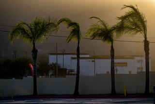
A chilly, drizzly, traffic-snarled end to 2021 across parts of California

- Share via
After a chilly, drizzly Christmas Day, Angelenos will get a quick reprieve with sunny skies on Sunday before another winter storm rolls in Monday, again drenching the region and promising a frigid end to 2021.
“We’ve got a pretty vigorous cold front moving through,” said Joe Sirard, a meteorologist for the National Weather Service. “It’s going to stay quite cold for December, much below normal.”
The storm — its main front projected to reach L.A. County on Monday afternoon — could produce 55 mph wind gusts, up to an inch of rainfall across much of the region and between 5 and 10 inches of snow in the mountains, descending to slightly lower than 4,000 feet, which forecasters said could complicate travel along Interstate 5 through the Grapevine.
In Northern California, a snowstorm Saturday closed a stretch of Interstate 80 from the Nevada state line to Colfax, Calif., which is west of Lake Tahoe. The interstate remained closed in both directions Sunday morning, and officials said it would remain closed all day. They will reassess on Monday, officials said, adding that they had no estimated time of reopening.
Forecasters said rain showers in the Bay Area, which were scattered across the region Sunday morning, will pick up Sunday night and continue into Monday. The precipitation will break late Monday, forecasters said, but return Tuesday into Wednesday.
The Sierra Nevada region remains under a winter storm warning until Monday night, forecasters said, noting that travel in parts of the region will be very difficult if not impossible. If people absolutely must travel, officials urged them to keep an extra flashlight, food and water in their vehicle.
On Sunday morning, the UC Berkeley Central Sierra Snow Lab reported that it’d officially registered 29 inches of snow at the lab in the last 24 hours, bringing the total for the month to 155 inches — nearly 13 feet and only 2 feet shy of breaking the record for the all time snowiest December since 1970, when the measurement was 179 inches.
Back in Los Angeles, mostly sunny skies are expected on Tuesday, but temperatures will remain far below average, hovering in the upper 40s and low 50s, Sirard said, noting that in some parts of the region Tuesday may bring near record low maximum temperatures for the day.
Another storm is expected to roll in on Wednesday and remain through Thursday, but conditions are expected to be dry on New Year’s Day.
More to Read
Sign up for Essential California
The most important California stories and recommendations in your inbox every morning.
You may occasionally receive promotional content from the Los Angeles Times.


