‘The worst of it still in front of us’ as new storms set to pound a rain-weary California

- Share via
SACRAMENTO — California is bracing for another week of destructive storms that will probably bring flooding and hazardous winds Monday to an already battered state.
A series of atmospheric rivers that pummeled coastal communities last week and left more than 400,000 without power in California on Sunday will be followed by particularly brutal weather as rivers reach flood levels and powerful winds wreak havoc, forecasters fear.
“We expect to see the worst of it still in front of us,” Gov. Gavin Newsom said Sunday. “We’re anticipating very intense weather coming in [Monday] and Tuesday morning.”
Newsom asked the Biden administration to declare a federal emergency before new weather arrives, saying that the most extreme conditions are expected in the first 48 hours of the week.
The powerful storm that knocked out power, toppled trees — including one that killed a toddler — and flooded homes along the coast in Santa Cruz continued its march through the region.
Evacuation warnings or orders were issued in parts of Santa Clara, Alameda, Sacramento, Sonoma, Monterey and Santa Cruz counties, with forecasts suggesting that swollen rivers could flood businesses and homes.
“SEVERE WEATHER ANTICIPATED ON MON — AVOID TRAVEL,” electronic freeway signs read in the San Francisco Bay Area on Sunday.
San Jose officials were gearing up for what could be the worst flooding to hit the San Francisco Bay Area’s most populous city since the surprise flooding in 2017 of Coyote Creek, which forced more than 14,000 residents out of their homes.
Water district officials warned of possible flooding in San Jose at the Guadalupe River near the Tamien station of the Caltrain commuter rail system, affecting the Northern Cross neighborhood, Ross Creek at Cherry Avenue south of downtown, and Upper Penitencia Creek near the Berryessa/North San Jose BART station.
The Santa Clara Valley Water District on Sunday issued an “extreme weather alert.” Flooding is possible in the coming days in Palo Alto, Menlo Park, Sunnyvale, Morgan Hill and Gilroy.
Evacuation warnings were issued downstream of two full reservoirs in Santa Clara County: the Uvas Reservoir northwest of Gilroy, whose water flows into Uvas Creek; and the Pacheco Reservoir, which empties into Pacheco Creek alongside Highway 152 — a main route between the San Francisco Bay Area and Interstate 5.
Evacuation warnings in Santa Cruz County included towns east and southeast of Santa Cruz, including Soquel, Seacliff, Rio del Mar and Watsonville, which borders the Pajaro River.
Monterey County Sheriff Tina Nieto said the Carmel, Pajaro and Big Sur rivers will probably reach flood stage on Monday, and the Salinas River on Tuesday. Evacuation warnings were issued along the Carmel Valley, where the Carmel River could flood.
Alameda County issued evacuation warnings for the hills east of Hayward and Fremont and west of Pleasanton. Sacramento County issued an evacuation order for the Wilton area along the Cosumnes River, whose waters breached levees over New Year’s Eve, killing three motorists whose bodies were found in or near submerged cars near Highway 99.
As of Sunday afternoon, 424,000 customers were without power in California, according to the state’s Office of Emergency Services. More than 375,000 customers lost power in Northern California overnight Saturday as the latest powerful winter storm pushed through the region, elevating the danger for flooding and bringing intense winds that downed trees.
In the Sacramento area, one of the hardest-hit regions, wind gusts topped 60 mph and caused many to lose power, according to the National Weather Service. Utility officials have been working to restore power and said it will take time.
Pacific Gas & Electric deployed 4,000 crew members dedicated to storm restoration: their own personnel, contractors and mutual aid from Southern California and as far away as Wyoming and Canada.
“We are just getting repeatedly pounded by storm after storm,” said Tracy Correa Lopez, a spokeswoman with PG&E. “Flooding is an issue. The number one issue right now is access to a lot of these areas.”
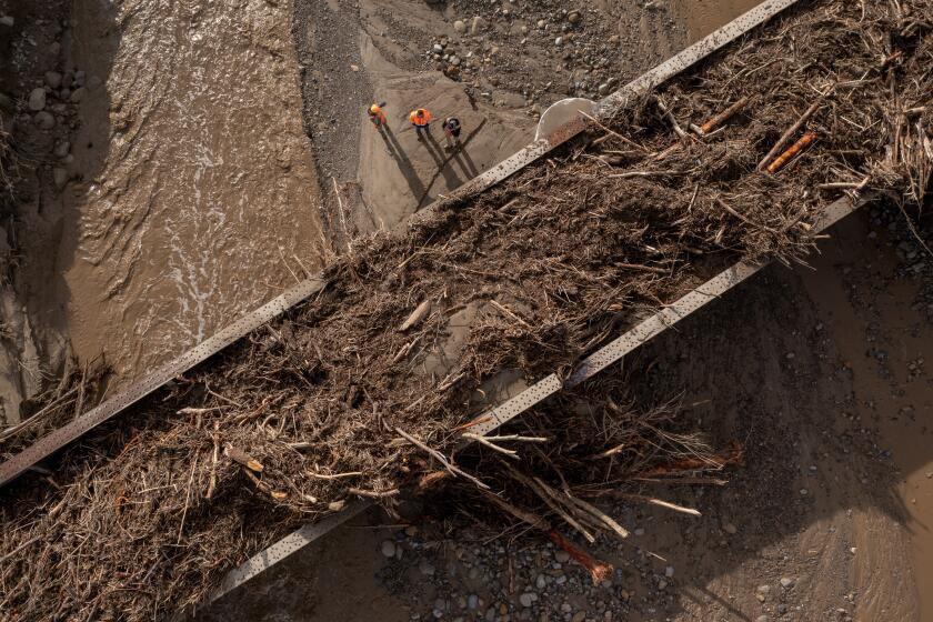
Flooding, downed trees and unstable soil contributing to falling rock and debris flows are all likely to pose hazards for crews seeking access to turn the power back on, Correa Lopez said.
For days, forecasters had warned of a “relentless parade of cyclones” barreling out of the Pacific toward California, and continuing until about Jan. 19, intensifying the risk of flooding in parts of the state this week. A flood watch remains in effect for the Sacramento and San Joaquin valleys and nearby foothills until 4 p.m. Wednesday.
The first of five atmospheric rivers arrived with a bang late Friday, as heavy rain and mountain snow struck Northern California, spreading to Central California on Saturday, with some parts of the state expecting more than a foot of snow through early Sunday.
Residents of Southern California, reeling from heavy rain and wind earlier this week, should expect a fresh storm system to buffet the region as early as Sunday night.
Forecasters expect the next storm that moved in Sunday night to be more powerful than the last one. Aside from some periodic breaks, much of the week is expected to bring heavy rain with more storms on the horizon, said Hannah Chandler-Cooley, a meteorologist with the National Weather Service in Sacramento.
Damaging winds with gusts between 45 and 60 mph were expected Sunday night until Monday morning in the Sacramento and San Joaquin valleys, Chandler-Cooley said.
“Make sure you have provisions on hand in case you have long-term power outages and a go-kit or evacuation kit if there is flooding in your area,” she said.
Two to 3 inches of rain are expected in the region and 2 to 8 inches in the foothills near Sacramento.
“Not only are the winds strong, but the ground is already saturated,” Chandler-Cooley said. “It’s really easy for trees and power lines to fall.”
The storm system over the weekend brought significant wind and rain and toppled trees all over the city, Sacramento Mayor Darrell Steinberg said in a statement.
The number of trees that have been uprooted in this storm in the City of Trees is in the hundreds. Late Saturday night, winds howled through with a force that left giant redwoods, oaks and eucalyptuses with their roots torn from the ground, their trunks blocking streets, crushing homes and downing power lines.
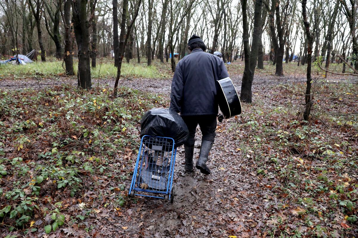
Saturday evening, a woman was killed when a tree fell on her tent. The Sacramento Fire Department said it responded to a call about 6:45 p.m. for a traumatic injury as rain and dangerous winds began in the capital. The department said the woman, who was unhoused, had not survived the injuries.
City officials said she was living along one of the many wooded river levees that have been the focus of outreach efforts in recent days, as advocates and social workers have attempted to warn people of the dangerous storms approaching and offer options for shelter. Those levees routinely flood during large storms.
“The fact that a human being lost her life in last night’s storm is heartbreaking,” Steinberg said. “Our outreach teams have been working along the levee and elsewhere in the city to urge people to go to one of our respite centers or at least get to high ground away from large trees.”
Yana Garcia, the secretary for the California Environmental Protection Agency, advised people to avoid floodwaters, which may be untreated and contain harmful chemicals.
“Although this storm has been dangerous, it will help by providing California’s reserves with more water. But we can’t say yet that the drought is over,” Garcia said at a news conference.
Other waterways that could see flooding include the Russian River in Sonoma County at Guerneville and at Geyserville; Mark West Creek near the community of Mirabel Heights; Laguna de Santa Rosa at Stony Point Road west of Rohnert Park; and the San Lorenzo River north of Santa Cruz. An evacuation warning was in place along the Russian River downstream of Healdsburg to the coast.
In Mendocino County, the Navarro and Garcia rivers are already flooding highways. The Eel River near Arcata in Humboldt County is being closely monitored. In the Central Valley, flooding is expected on the Mokelumne and Tuolumne rivers. Bear Creek, which bisects Merced, could reach record flood levels, to 27.1 feet by Tuesday morning; the record is 24.65 feet in 2006.
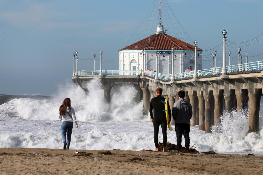
Officials in Santa Cruz County are not only watching waves batter coastal communities, but also keeping an eye on saturated soil in the mountains — which are becoming increasingly vulnerable to slides.
Then there are the rain-swollen rivers. Typically, those rivers would rush downstream into the ocean. But given the size of the storm surge, water is getting pushed back as it tries to escape — flooding lowland areas along creeks and rivers, said Melodye Serino, a deputy county administrative officer.
She said residents are trying to prepare, but that’s hard to do when it’s unclear where the threat is going to come from: rain, storm surge, flooding or all three.
Garrison and Chabria reported from Sacramento, Lin from San Francisco and Carcamo from Santa Ana. Times staff writers Matt Ormseth, Laura Newberry and Vanessa Arredondo contributed to this report.
More to Read
Sign up for Essential California
The most important California stories and recommendations in your inbox every morning.
You may occasionally receive promotional content from the Los Angeles Times.


