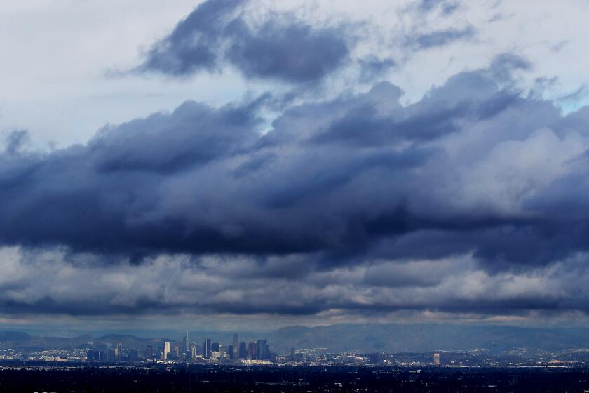
L.A.’s second big winter rainstorm is coming. What you need to know

- Share via
The first in what’s expected to be a series of three atmospheric river storms has arrived in California.
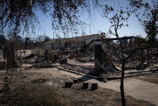
Forecasters are hopeful the winter storms might finally lift Los Angeles County from the throes of a devastating fire season. But there is still the risk that heavy rainfall around recent burn areas could trigger dangerous mudslides and debris flows — a particularly concerning prospect in areas of Pacific Palisades and Altadena devastated by the Palisades and Eaton fires.
Here’s what you need to know:
It could rain for many hours each day in the middle of next week as the edge of one of these storms takes a swing into Southern California, forecasters say.
Timing
Los Angeles and Ventura counties
Widespread rain is expected Tuesday through Wednesday, with a chance of lingering showers Thursday. The peak of the storm is expected between 10 p.m. Tuesday and noon Wednesday.
Just the one atmospheric river storm — a relatively weak one, at that — is expected for this area.
“Presently, the most likely scenario is for moderate rain amounts ... and generally beneficial rain for the area,” said Rose Schoenfeld, a meteorologist with the National Weather Service office in Oxnard. “However ... there is that small potential for significantly higher rain amounts.”
San Diego and Orange counties and the Inland Empire
There’s a a chance of rain Wednesday and a slight chance of rain Tuesday and Thursday. Significant rainfall is not expected.
Santa Barbara and San Luis Obispo counties
The peak time for rain will be from Tuesday at noon through 6 a.m. Wednesday. The two counties could also get very light rain over the weekend — perhaps one-tenth of inch of rain or less.
Northern California
Three atmospheric river storms are set to douse Northern California — the first through Sunday, another Monday and Tuesday, and the last Wednesday and Thursday. Expected snowfall has potential to jumpstart a sluggish snowpack — key to the state’s water supply.
The California Highway Patrol has already begun to require chains for vehicles traveling over the Donner Summit on Interstate 80.
Another rain event is heading to fire-weary Los Angeles next week. Meanwhile, Northern California is in for an atmospheric river.
Risk of mudslides, debris flow
While moderate, generally beneficial rainfall is expected in L.A. County, the precipitation could bring a minor to moderate risk of debris flows and mudslides in some recent burn areas, such as around the Palisades and Eaton fires.
The wildfires have made soil repellent to water. During heavy rains, water can easily flow across burn scars and pick up rocks, branches and sometimes massive boulders, sending debris flowing downhill quickly — with destructive and sometimes deadly consequences.
“There is some risk. … There is likely to be a good amount of areas that will see periods of [rain falling at a rate of] a half-inch an hour, and that is the threshold for debris flows,” Schoenfeld said. “So we may see some impacts with this storm.”
There are also several other fresh burn areas around the region: the Hurst fire near Sylmar; the Hughes fire around Castaic Lake and near Santa Clarita; the Kenneth fire not far from Calabasas; the Sunset fire in the Hollywood Hills; the Franklin fire in the Malibu area; and the Bridge fire in the San Gabriel Mountains, west and southwest of Wrightwood.

Mudslides and debris flows were a concern during the region’s first major winter storm last weekend, which dropped a half-inch to 1½ inches of rain across L.A. County. Fortunately, the heaviest rainfall avoided burn scars. Still, several roadways were closed on account of minor flooding and deep mud.
Could this next round of rain end fire season?
Downtown Los Angeles received 0.54 inches of rain during the last storm, and could get an additional 0.83 inches Tuesday through Thursday. More rain is possible Friday into Saturday.
Meteorologists say the region needs to see 2 to 4 inches to comfortably consider the wildfire season over.
With the upcoming rains, “we’re getting closer to that,” Schoenfeld said. “I can’t say for sure, but it’s definitely a possibility” that L.A. County is approaching a definitive end to the fire season.
The heaviest rainfall has slowed across Southern California. While the storm caused some mudslide and flooding issues, officials say it was largely beneficial.
Rainfall totals
The most likely scenario for L.A. and Ventura counties is for between half an inch to 1.5 inches of rain to fall Tuesday through Thursday, with 1 to 3 inches expected in the mountains and foothills. For Santa Barbara and San Luis Obispo counties, 1 to 2 inches are expected, with 2 to 4 inches in the mountains and foothills.
Covina could get seven-tenths of an inch of rain; Long Beach, three-quarters of an inch; downtown L.A. and Redondo Beach, five-sixths of an inch; Santa Clarita, nine-tenths of an inch; Thousand Oaks, Canoga Park and Pyramid Lake, about 1 inch; Oxnard and Fillmore, about 1.2 inches; Santa Barbara, 1.53 inches; and Cambria, 1.96 inches.
Under this scenario, there could be “mudslides and road erosion for sensitive roads — especially in canyons — higher river flows and some amount of rock slides,” Schoenfeld said.

“If it happened to wobble a little more to the south, L.A. County could see higher rain rates, and then San Luis Obispo ... and Santa Barbara counties might see lower rain totals and rates,” Schoenfeld said.
A heavier scenario could see more than 1.6 inches of rain fall in downtown L.A., Long Beach and Redondo Beach, and more than 1.8 inches in Santa Clarita.
That would heighten the risk of road flooding and debris flows in recent burn areas.

There’s also an underperforming scenario in which downtown L.A., Long Beach and Redondo Beach could get only about one-third of an inch of rain.
Both the “worst-case” and “low amount” scenarios have a 10% to 20% chance of occurring, forecasters said Friday.

The storms are expected to be stronger in Northern California. For this weekend, a flood watch is in effect from the San Francisco Bay Area, the Sacramento Valley and northern San Joaquin Valley reaching east toward Reno.
Moderate rain fell in the Bay Area on Friday, and a second round of heavier rain is expected Saturday morning into the early afternoon. Light rain is expected in the area Sunday, and another round of moderate rain is forecast for Monday, according to the weather service office in Monterey.
“Excessive runoff may result in flooding of rivers ... and other low-lying and flood-prone locations,” the Monterey office said. “Those living in areas prone to flooding should be prepared to take action should flooding develop.”
California’s snowpack stands at 65% of average for this time of year. After a dry January, major storms are forecast to bring more rain and snow.
Snow
For L.A. County, the upcoming midweek storm is going to be quite warm, Schoenfeld said — a sharp contrast to the much colder storm that hit a week ago.
Only the highest peaks of the San Gabriel Mountains and the mountains in Ventura County are expected to see snow. This storm isn’t expected to bring snow to the Grapevine section of Interstate 5, which traverses the Tejon Pass and connects L.A. County with the Central Valley.
Northern California is expecting plenty of snow, on the other hand. The three atmospheric rivers forecast there “will bring periods of significant rainfall [and] mountain snow over the next week,” said Courtney Carpenter, a meteorologist with the weather service’s Sacramento office.
The second and third waves of the storm “will be colder, with more significant mountain snow, travel impacts, and feet of snow by the time it all winds down,” Carpenter said.
Much of Angeles National Forest reopened Thursday after a weeks-long closure because of wildfires and red flag warnings, but some beloved trails and campgrounds will remain inaccessible while the land recovers from the blazes.
The National Weather Service office in Reno issued a backcountry avalanche watch through next Saturday, indicating high avalanche danger for the greater Lake Tahoe area.
Ending dry January
Much of Southern California has seen only one significant rainstorm over the last eight months, a record-dry start to the water year that began Oct. 1. In the lead-up to the Palisades and Eaton firestorms in January, the bone-dry landscape kept vegetation ripe for flames — a recipe for disaster when combined with strong Santa Ana winds and an ignition source.
Northern California was off to a much better start to the rainy season in November and December, but then also saw a dry January. After kicking off January with an above-average snowpack in the Sierra Nevada, the state’s latest snow survey on Friday found that it had since dipped to 65% of average for this time of year.
“California missed out on critical snow-building storms in January, which has pushed the state down below average for this time of year,” said Karla Nemeth, director of the state’s Department of Water Resources. “While we are excited to see some storm activity in the coming days, sustained periods of no precipitation can dry the state out very quickly. For each day it’s not snowing or raining, we are not keeping up with what we need.”
Gov. Gavin Newsom signed an executive order Friday to maximize the state’s collection and storage of water ahead of the upcoming storms.
The U.S. Army Corps of Engineers just opened up two California dams. A spokesperson says the flows are ‘controlled’ and being coordinated with local officials.
“As we anticipate rain and snow in Northern California, we are also preparing to use every last drop to boost our water supply for communities and farms throughout the state,” Newsom said in a statement. “We are creating a literal rainy day fund to help us recover from a multi-year drought and prepare for our hotter, drier future.”
Newsom said Thursday that the state had deployed resources and staff ahead of the storms to respond to potential emergencies.
“We know from experience that these storms can pack a punch,” he said. “The best thing people can do now is to prepare and stay alert.”
The California Governor’s Office of Emergency Services is suggesting that residents stay inside during the storms to reduce the risk of injury from falling trees, and is urging motorists not to drive through flooded roads and to prepare for possible power outages.
For people living near burn areas, authorities suggest learning evacuation routes and preparing go bags in case they need to evacuate quickly.
More to Read
Sign up for Essential California
The most important California stories and recommendations in your inbox every morning.
You may occasionally receive promotional content from the Los Angeles Times.


