X-ray technology reveals California’s forests are in for a radical transformation
- Share via
reporting from SACRAMENTO — Biologist Greg Asner first heard the numbers in April, but they did little to prepare him for what he saw.
The Forest Service had estimated that nearly 12.5 million trees in the state’s southern and central forests were dead. But as Asner peered down upon the same forests from his airplane at 6,000 feet, he saw something far worse.
California’s drought-parched landscape was poised for a radical transformation. Much of the low-elevation forests near Mt. Pinos in the Los Padres National Forest and in Pinnacles National Park were going to disappear if trends continued.
A scientist with the Carnegie Institution for Science, Asner has a practiced eye for forest health, and with instruments aboard his plane that give him X-ray eyes into the foliage, he is able to assess not just dead trees but trees so stressed by the drought that their death is likely.
For three weeks this summer, he and his team flew out of Sacramento and Bakersfield, recording the devastation. Even if the drought were to end in a historic El Niño this winter, Asner worries that the most stressed trees will continue to fail.

There is no saying which trees will die, but by his estimation the count statewide could be close to 120 million — as much as 20% of the state’s forests.
Tarnished beauty
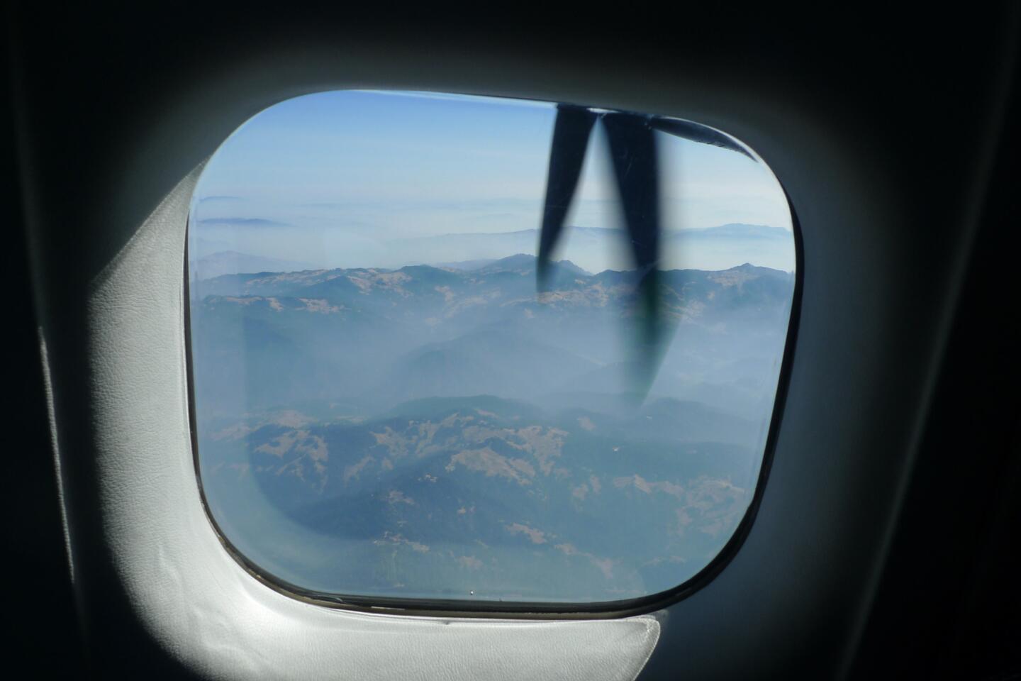
On a hot summer morning, Asner boards his Dornier 228, a twin turboprop, at McClellan Airfield on what he hopes will be the final day of his survey. He needs to fly along the coast toward the Oregon border, but conditions are deteriorating.
An armada of firefighting aircraft has taken off at dawn to fight an outbreak of new wildfires to the north. The air is hazy with smoke.
NEWSLETTER: Get essential California headlines delivered daily >>
Above the city of Santa Rosa, the plane veers northwest over the forests west of Guerneville toward the Lost Coast.
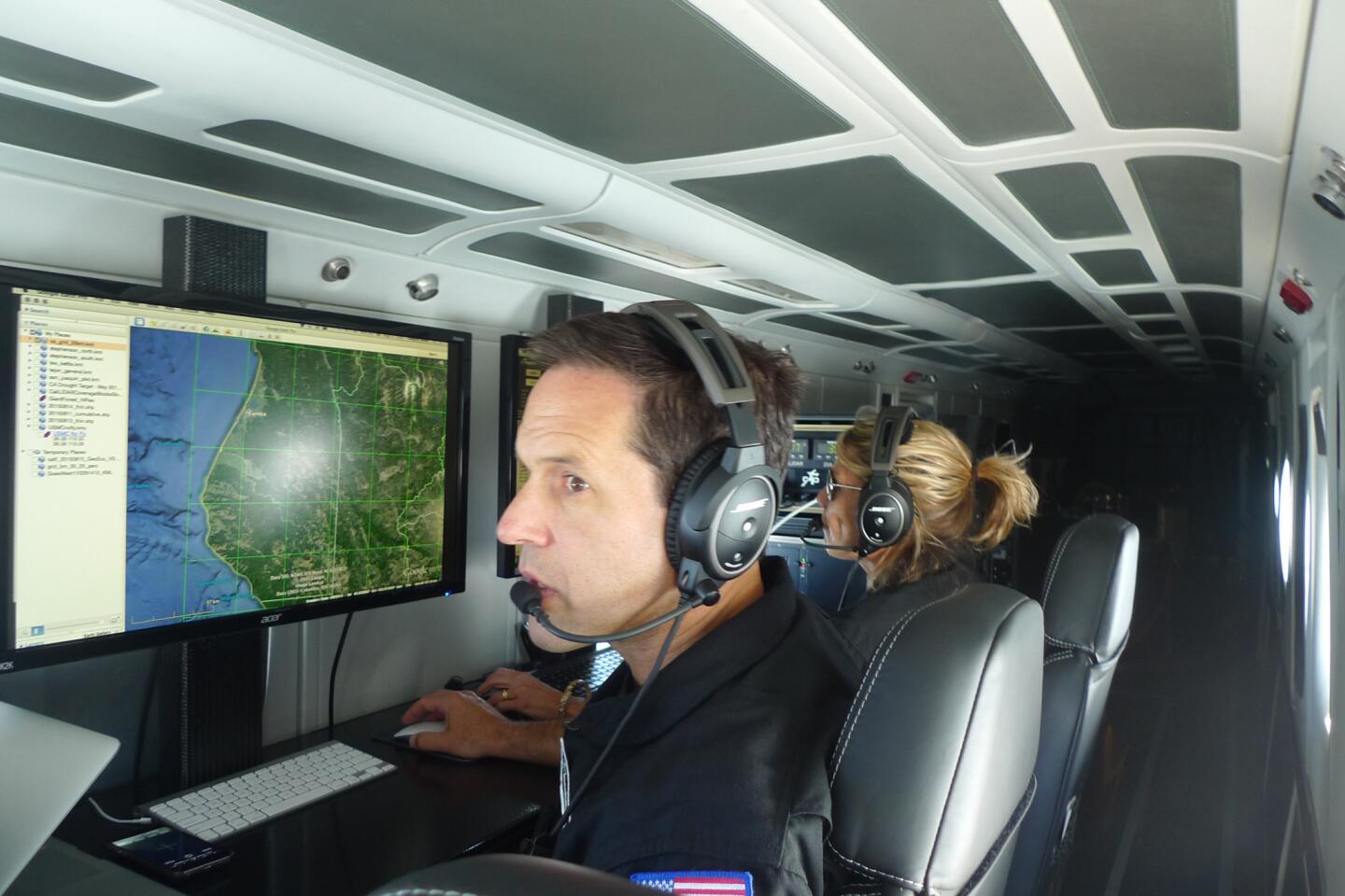
Asner, 47, sits in the cabin with Robin Martin, who manages the instruments and relays navigation instructions to the cockpit. They work in front of two monitors. She’s a lefty and he’s a righty, so they share a mouse pad. It helps that they are married.
To understand how Asner’s instruments work, you have to first step inside a leaf. There amid the busy factory of photosynthesis, water molecules are bending, stretching, rotating and vibrating.

By marrying data from the onboard spectrometer and laser, Greg Asner is able to create vivid topographic images of specific terrain. Flying above Crescent Meadow in Kings Canyon-Sequoia National Park, he is able to identify the most vulnerable trees
These motions resonate into the atmosphere as reflected light, which is picked up by an on-board spectrometer that divides it into 480 bands from ultraviolet to shortwave.
Much like star light reveals a star’s distant chemistry, these bands are analyzed for their chemical content. Water is the primary focus: The more water in the leaves, the less reflected light, and the more reflected light, the drier the foliage.
The spectrometer works in conjunction with a laser that fans out beneath the aircraft, creating a 3-D image of the forest below.
By marrying the data from the spectrometer and the laser, Asner creates topographic images that show the condition of the forest. Healthy trees are blue, and drought-stressed trees run from mild (yellow) to severe (red).
The images help him to correlate terrain and tree stress. Higher tree stress, for example, often occurs on steep slopes and near meadows.
For Asner’s mostly Canadian crew, the Golden State is a tarnished beauty.
“It’s just burnt,” says pilot Don Koopmans of Saskatchewan.
Asner’s assessment is equally blunt.
The mountains ringing Los Angeles are “a tinderbox.”
The oak forests in the Sierra foothills are “in big trouble.”
Pinnacles is “not a happy place for a tree,” and the forests northwest of Redding are surprisingly compromised.
To explain what 120 million trees dying across the state might mean, Asner paints a picture of California’s ecological diversity and size. He then takes out his calculator.
He estimates there are 585 million to 1.6 billion trees in the state’s forests and apologizes for not being more precise. An accurate census, he says, has never been conducted, but 120 million represents 7% to 20%. Under normal circumstances, forests lose between 1% and 1.5% of their trees annually.
“At what point will the forest change into something else? We don’t know,” Asner says. “We don’t know when the lack of rain will lead to runaway conditions where the forests are beyond repair.”
Such a transition, especially in the lower elevations, is already underway in parts of the West, where nearly 6 billion trees — 13% of the area of western forests — died from 1997 to 2010 because of drought and the bark beetle.
Yet as grave as the effects of the drought have been, Asner insists there is hope.
“If I looked around and thought there was no way to deal with these problems, I would be pessimistic,” he says. “But there is a way with effective management.”
Among other things, aerial images can help land managers identify vulnerable terrain and consider how to strengthen stressed trees and protect healthy ones.
A march uphill
The study of forests is a formative science, and conclusions — like a definitive number for the trees that will die — are hard to come by.
Park Williams, a bioclimatologist at the Lamont-Doherty Earth Observatory at Columbia University who has been studying the California drought, is not surprised by Asner’s numbers.
If only half succumb, it would register as a very big event, Williams said.
“Think of it as one gigantic ax swing at the forest,” he said. “It takes a huge chunk out of the population, and if we see two or three more of these droughts, then that’s even more ax swings.”
Jeffrey Hicke, an associate professor in the department of geography at the University of Idaho, said that regardless of current tree mortality rates, the state will not lose its forests entirely. But he adds, based on the observations, the low-elevation forests are in greatest jeopardy.
Beyond this year’s drought, as climate change brings warming, tree species will migrate, Hicke said. Older trees will die, and younger trees will take root.
“Species will march uphill as the climate warms,” Hicke said. “Sequoia forests might become ponderosa pine or oak. Oak forests might become grasslands. There won’t be a wholesale conversion of forest to non-forest, at least not initially.”
The Forest Service survey of California forests, an annual assessment made more urgent by the drought, follows a protocol more low-tech than Asner’s. Flying at 1,000 feet, two observers count dead trees and extrapolate over football field-size plots. With their brown, burnt foliage, dead trees are easy to read.
The observers, though, cannot see what Asner’s instruments detect: the number of trees in stress.
Flying over more of the state this summer, the agency had tallied 21 million dead trees statewide. Recent fires have prevented observers from completing the work.
Asner hopes to fly the state again, possibly by next spring, to chart progression of the damage. But first he needs to find agencies that will pay for his work. The cost for the three-week mid-summer survey was $250,000, paid by a grant from the David and Lucile Packard Foundation.
The foundation funded the research because Asner “is measuring the world in a different way,” said Chad English, the foundation’s science program officer. “This gives us an opportunity to ask new questions and gives us a chance to reshape the problems in front of us.”
Asner believes the data will give state officials an opportunity to manage forests in the context of drought and climate change.
The California Department of Forestry and Fire Protection, he says, is interested in the findings because the images can provide a more accurate picture of how fire behaves in dry terrain, which can help with the location of fire breaks and the management of controlled burns.
Asner also has met with representatives from the California Environmental Protection Agency, whose deputy secretary for the state’s climate policy, Ashley Conrad-Saydah, was stunned when she saw his findings.
Water and Power is The Times’ guide to the drought. Sign up to get the free newsletter >>
“Our current survey methods tell us something different from what Greg is telling us,” she said. “We can fly over, do remote sensing and take physical measurements of the trees, but you don’t get a sense of how bad the drought is for these iconic landscapes that make California whole until you see his data.”
Diminishment of the state’s forests means the loss of clean water and erosion control, recreation and jobs, Conrad-Saydah said. As trees die, decompose or burn, carbon is released into the atmosphere, contributing to global warming, she said. Forests become scrublands with 97% less carbon.
‘This is our chance’
A little before noon, Asner’s flight is cut short by smoke and the Dornier soon passes over the patchwork suburbs of Sacramento and lands.
Asner knows that dying trees play well in the media, but they have an unfortunate side effect of turning “viewers numb and decision-makers to other issues they think can actually be managed.”
He hopes there’s an alternative.
“This is our chance for science to play a role in supporting innovations in management and policy, rather than just bringing bad news that is not actionable,” he wrote in a recent email to colleagues, both a reminder and a challenge.
Once back in the hangar, Asner opens the side doors of the Dornier. The Sacramento blast furnace hits him in the face. It’s 108 degrees.
Twitter: @tcurwen
ALSO
Garcetti’s South L.A. forum ends abruptly because of Black Lives Matter protesters
Growing homeless problem prompts HUD leader, local officials to meet
Will California’s end-of-life law push lethal drugs over costlier care?
More to Read
Sign up for Essential California
The most important California stories and recommendations in your inbox every morning.
You may occasionally receive promotional content from the Los Angeles Times.


