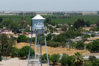
San Joaquin Valley continues to sink because of groundwater pumping, NASA says

Subsidence occurs when water is removed from underground aquifers and the surrounding soil collapses on itself. (Feb. 10, 2017)
- Share via
California’s San Joaquin Valley continues to sink at an alarming rate because of groundwater pumping and irrigation, according to a new study by NASA.
Ground levels in some areas have dropped 1 to 2 feet in the last two years, creating deeper and wider “bowls” that continue to threaten the vital network of channels that transport water across Southern California, researchers say.
The findings underscore the fact that even as record rain and snow have brought much of California out of severe drought, some parts of the state will probably struggle with water problems for years to come.
Despite a new series of storms that battered California this week, state water regulators decided Wednesday to maintain drought restrictions for at least a few more months as they continue to assess recovery.
Researchers said subsidence has long been a problem in parts of California. “But the current rates jeopardize infrastructure serving millions of people,” said William Croyle, acting director of the state Department of Water Resources. “Groundwater pumping now puts at risk the very system that brings water to the San Joaquin Valley.”
Subsidence occurs when water is removed from underground aquifers and the surrounding soil collapses on itself. Even if the underground water is replenished, subsided basins can’t hold as much water as they did previously.
In the case of the Central Valley, where subsidence is uneven, roads and irrigation canals that span broad areas of terrain can buckle and break. Since the 1960s, subsidence-related repairs have cost the State Water Project and Central Valley Project $100 million.
The NASA study, which was based on satellite data, found that groundwater pumping near the California Aqueduct in Kings County resulted in a ground level drop of more than 2 feet between July 2013 and June 2016. The drop forced authorities to reduce aqueduct flow so water didn’t wash over the channel’s concrete banks.
The satellite data also revealed ground-surface depressions along short portions of the California Aqueduct, which carries supplies from Northern California to the San Joaquin Valley and Southern California.
The largest bowl, which is near Corcoran and extends 60 miles, sank roughly 22 inches between May 2015 and last September, the report stated. An earlier 2015 study reported a 3-foot drop in ground level, but over a period of four years.
Subsidence in a 25-mile-wide bowl near El Nido measured 16 inches between May 2015 and September 2016. Some of the subsidence there was not caused by groundwater pumping, but by the irrigation of local nut groves, officials said.
The Central Valley aquifer extends for about 400 miles under the Sacramento and San Joaquin valleys. The subterranean water, some of which seeped into the ground 10,000 to 20,000 years ago, constitutes the state’s largest reservoir. Agricultural pumping from the aquifer has gone unregulated and unmonitored for decades, and there are no good figures on how much water has been removed.
It remains unclear how California’s current, unusually wet winter may affect the state’s aquifers, if at all, researchers say.
The study was authored by researchers with Caltech and the Jet Propulsion Laboratory.
Times staff writer Bettina Boxall contributed to this report.
For breaking California news, follow @JosephSerna on Twitter.
ALSO
Despite epic rain and snow, California keeps emergency drought restrictions in place
A week in the life of P‑22, the big cat who shares Griffith Park with millions of people
UPDATES:
7:40 p.m.: Updated with context about the drought.
More to Read
Sign up for Essential California
The most important California stories and recommendations in your inbox every morning.
You may occasionally receive promotional content from the Los Angeles Times.


