It’s going to heat up this week. Again.

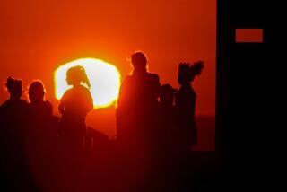
Sal Munir takes a break from putting up fencing at the Rose Bowl on Sept. 10. The washcloth had been wrapped in ice in a cooler.
- Share via
If you thought Southern California’s cooler weekend weather was here to stay, sorry.
Temperatures across the Southland are expected to hit triple digits -- again -- in the coming days, according to the National Weather Service.
The low-pressure system that fueled scattered showers in Los Angeles County on Sunday is expected to be pushed eastward and replaced by a strong high-pressure system moving in from the ocean, said Stuart Seto, a weather specialist with the National Weather Service in Oxnard.
That high-pressure system is to blame for the heat wave, Seto said.
“It’s going to be happening very rapidly,” Seto said. “Starting Tuesday, we’re going to see a warming trend that will last to the end of the week, and we’re going to see temperatures really climbing, probably not to record levels but well above normal.”
In downtown Los Angeles, temperatures will be above normal by Wednesday and keep rising. The normal for this time of year in downtown is about 80 degrees, Seto said. On Wednesday, temperatures will be in the mid-80s and could reach 97 degrees Saturday and Sunday.
Area beaches, where the normal is in the high 70s, will see temperatures in the 90s over the weekend.
And in the usual “hot spots” -- looking at you, San Fernando Valley -- it’s going to be boiling this weekend, with triple-digit temperatures, Seto said.
Woodland Hills could hit 103 degrees, Seto said.
“It’s really going to evaporate all the good water we got” in the recent rainstorm, he said.
Even the overnight temperatures will be about 10 degrees above normal this week, Seto said.
A cluster of thunderstorms on Monday afternoon brought heavy rain and some lightning to East Los Angeles and to portions of the San Gabriel Valley, including Pasadena, Arcadia and West Covina, according to the Weather Service. Some local flooding was occurring near San Gabriel and Temple City, where rain was falling at an estimated 2 inches per hour.
“We’re seeing the last little bit of rain from this low-pressure system as it’s pushing east,” said Robbie Munroe, as meteorologist with the National Weather Service in Oxnard. The intensity of the “continually evolving” storms, he said, surprised forecasters.
The evening commute could be a soggy one in those areas, with some roadway flooding possible, the Weather Service said. Thunderstorms could develop across Los Angeles County throughout the evening, he said.
Another cluster of thunderstorms was moving through Simi Valley on Monday afternoon, toward Agoura Hills, with hourly rainfall rates up to a half inch.
This past weekend’s rainfall totals were variable over the Los Angeles region. Opids Camp, about 3,500 feet above Pasadena in the Angeles National Forest, had 1.84 inches of rain and La Verne got 1.22 inches, the weather service said. Meanwhile, downtown Los Angeles got about a tenth of an inch. In Beverly Hills, it was just sprinkles, with .01 inches of rain.
On Monday, the Mountain High ski resort in the Angeles National Forest near Wrightwood reported its first snow of the season, the “earliest snowfall in recent memory.” Up to an inch of snow covered the mountain, according to the resort.
“The first snow of the season is always exciting,” Mountain High spokesman John McColly said in a statement. “Fresh powder this early in October is a very good sign of things to come.”
Adding that resort staff have been keeping an eye on a potentially strong El Niño this winter, McColly said they are “absolutely stoked about the season ahead.”
Twitter: @haileybranson | Google+
ALSO
Massive industrial fire sends black plume of smoke over L.A. area
Man killed by LAPD after officers’ car window shattered had no firearm
Mighty 20-pound French bulldog scares off three bears from Monrovia home
More to Read
Sign up for Essential California
The most important California stories and recommendations in your inbox every morning.
You may occasionally receive promotional content from the Los Angeles Times.


