New warnings about risk of major flooding on L.A. River amid new development, revitalization

- Share via
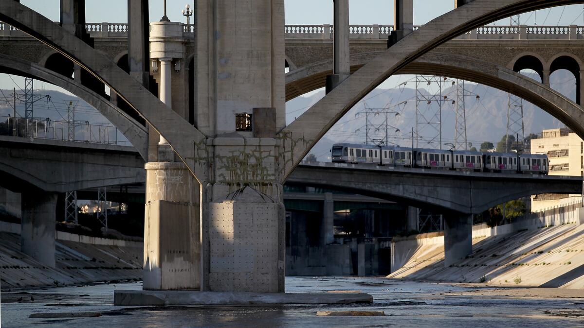
For decades, urban planners and city leaders have envisioned transforming the gritty, concrete-walled Los Angeles River into the backbone of a new kind of city, one with the riverbed restored to nature, surrounded by parks, trails and new residential developments.
But Los Angeles this week received a stark reminder that the river that cuts through the region — much of the year just a trickle — can become a dangerous torrent during periods of intense rain.
A new U.S. Army Corps of Engineers report found that more than 3,000 parcels north of downtown Los Angeles in neighborhoods such as Atwater Village and Elysian Valley could be submerged by an average of 5 to 10 feet of water in the event of a 100-year storm. It also found that other areas such as Griffith Park, Glendale and Burbank could see significant flooding.
Property owners with federally backed mortgages will be required to purchase flood insurance because of the findings, federal officials said.
Additionally, developers could face new restrictions such as having to build the first floor at a higher elevation for properties within the flood zone, according to city engineers.
The Army Corps released its study as the city pushes ahead with a plan for ripping out the concrete channels of the river and restore natural plant life. The concrete walls were installed to better protect the city from periodic flooding when the L.A. river overflowed its banks.
Officials said they remain convinced the nearly $1.6 billion restoration can move forward without heightening the flood risk, though some said the Army Corps’ findings offer a reality check.
“As we look to the future of the river, we have to look through the lens of past devastating floods, which were the reason the river was channelized anyway,” said Councilman Mitch O’Farrell, whose district covers most of the affected areas. “We can’t forget the river is one piece of dynamic Mother Nature. We can’t forget that in the past it has caused havoc.”
The Army Corps study was launched last year after the restoration project uncovered discrepancies in the size of the floodplain in a section of the river that flows through Northeast L.A. and the Griffith Park area. Officials said some older maps showed a flood zone ending at the river’s channel while others showed the zone extending into neighborhoods.
The federal agency’s analysis found that more than 3,300 parcels are in the flood zone, far more than the 870 parcels officials previously identified.
The federal maps apply to land that has been determined to be subject to a so-called 100-year flood, which means there is a 1% chance that a flood of its size will happen during any given year. The last major flood in the area was in 1938, when L.A. County was inundated by torrential rain storms that killed more than 100 people and destroyed 5,600 homes.
The highly anticipated restoration project — expected to take 30 to 50 years — would introduce the most dramatic changes to the river since it was lined with concrete as part of a larger flood control initiative in the middle of the 20th century.
Besides removing concrete channels, the project also seeks to add water cleanup features and reintroduce native habitat along an 11-mile stretch of the river from the northern end of Griffith Park to downtown Los Angeles. Those changes would add long stretches of open space, city officials said.
As part of the effort, the city hopes to convert a multimillion-dollar piece of industrial property along the river. That area — known as the G2 parcel — is not in the flood zone released this week, city and federal maps show.
Still, Marissa Christiansen, senior policy director for Friends of the Los Angeles River, said it is unknown what the new flood zone rules will mean for revitalization efforts.
“I would hate for it to set us back,” she said. “My concern would be that this modeling is used as a basis to revert back to the thinking that the only appropriate flood risk mitigation is drastic, comprehensive concrete channeling of the river.”
The restoration plan triggered a land rush along the river, with once-affordable property values in neighborhoods such as Elysian Valley rising significantly. The addition of recreational space along the river have made those neighborhoods more desirable.
David de la Torre of Elysian Valley doesn’t think the new flood zone change will slow down the red-hot growth in the area.
“With the gentrification that is unfolding in the Elysian Valley right now, it’s such an attractive spot,” De la Torre said. “It is going to impact the middle- to low-income homeowners more.”
Plans for the river revitalization effort take into account the flood risk, and officials believe they will be able to “restore the river’s ecosystem while maintaining or even improving existing levels of flood risk management,” said Connie Llanos, spokeswoman for Mayor Eric Garcetti.
During a public hearing Monday in Griffith Park, residents expressed frustration over having to purchase insurance when no one could remember a significant flood event, especially during the recent years of historic drought in the region.
“I’ve never seen the L.A. River get anywhere close to the top,” said Ken Zavayna, a longtime resident of Atwater Village. “It’s stupid.”
Alfred Mata, a deputy city engineer, said he sympathizes with the concerns of residents.
“Who wants to spend more money, especially those who have lived here a long time?” Mata said. “But in the long run it’s in everyone’s interest to have these programs to protect property owners and the community at large.”
Property owners with federally backed mortgages can purchase insurance at a reduced rate until the Federal Emergency Management Agency makes the maps official in roughly two years, Army Corps officials said.
Premiums cost an average of nearly $700 last year, according to the National Flood Insurance Program. The insurance covers up to $250,000 in damages to a structure and up to $100,000 for its contents, FEMA officials said.
The federal government has been examining flood risks across the Los Angeles area in recent years.
Homeowners who live near Ballona Creek in southwestern L.A. were also mandated to buy flood insurance, Mata said.
In 2010, residents in more than 150 communities across the Southland were notified that they lived in high-risk flood zones and would be required to buy insurance.
Follow @bposton on Twitter.
Times staff writer Dave Zahniser contributed to this report.
More to Read
Sign up for Essential California
The most important California stories and recommendations in your inbox every morning.
You may occasionally receive promotional content from the Los Angeles Times.


