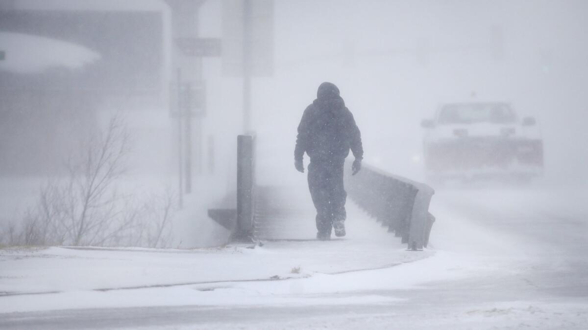
‘Epic’ cyclone storm brings blizzard, flooding and tornado threat to mid-U.S.

- Share via
Reporting from CHEYENNE, Wyo. — A window-rattling late winter storm brought blizzards, high winds and flooding to more than 25 states Wednesday, stretching from the northern Rocky Mountains to Texas and beyond.
“This is a very epic cyclone,” said Greg Carbin, chief of forecast operations for the National Oceanic and Atmospheric Administration’s Weather Prediction Center. “We’re looking at something that will go down in the history books.”
It could develop into the worst storm of its type in 35 or 40 years, he said.
Blowing snow forced major highways to close in Colorado, Nebraska, South Dakota and Wyoming. About 1,000 flights were canceled at Denver International Airport, and nearly 40 more were canceled at Colorado Springs, Colo.
“It caught me completely off-guard,” said Sarah Brin of Santa Fe, N.M., who was stranded at the Denver airport. It was supposed to be a brief layover on her flight home from the South by Southwest Film Festival in Austin, Texas, but it turned into an overnight stay.
She booked a room in a downtown hotel and reserved a spot on a shuttle van. But some shuttle trips were canceled because of the weather.
We’re looking at something that will go down in the history books.
— Greg Carbin, chief of forecast operations at NOAA
“We’ll see if they actually show up,” she said.
Many schools and government offices closed for the day. Xcel Energy reported more than 200,000 customers lost electricity in the Denver area.
Severe thunderstorms in north Texas damaged buildings and flipped over small planes parked at an airport.
Nebraska was bracing for heavy rains.
Flooding forced evacuations in northeast Nebraska and western Iowa, including the Pierce Manor retirement home in Pierce, Neb. Residents of Avoca, Iowa, were filling sandbags to keep floodwaters from spreading, and the American Red Cross set up a shelter for anyone who was displaced.
Parts of seven states were under blizzard warnings, and 20 states were under some level of high-wind alert, Carbin said. Tornadoes were possible on the storm’s eastern edge.
In New Mexico, high winds knocked 25 railroad freight cars off a bridge into a mostly dry riverbed near Logan, about 180 miles east of Albuquerque. No one was injured, the New Mexico State Police said.
A wind gust of 92 mph was recorded in the mountains northwest of Denver.
The storm was expected to drop up to 22 inches of snow in Wyoming, 14 inches in South Dakota and a foot in Colorado.
Forecasters said the winds would pile up snow into deep drifts. In the Denver suburb of Thornton, drivers were abandoning their vehicles in snow-clogged streets, police said.
The storm could last through Friday.
The culprit was a sudden and severe drop in ground-level air pressure in Colorado, the most pronounced dive since 1950, Carbin said. It was caused by a combination of the jet stream and normal conditions in the wind shadow of the Rockies.
Air rushed into the low-pressure area and then rose into the atmosphere.
“It’s like a vacuum cleaner, really,” Carbin said. And when that much air rushes higher into the atmosphere, it causes severe weather.
More to Read
Sign up for Essential California
The most important California stories and recommendations in your inbox every morning.
You may occasionally receive promotional content from the Los Angeles Times.


