Santa may not need the heavy red coat when he visits Southern California

- Share via
Santa might be able to lose the heavy red coat when he makes his rounds in the Southland, and he probably won’t need an umbrella either.
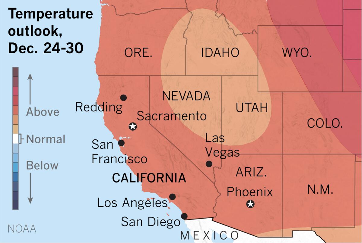
The extended outlook from the National Oceanic and Atmospheric Administration favors above-average temperatures and below-average precipitation in the Los Angeles region from Dec. 24 through Dec. 30.
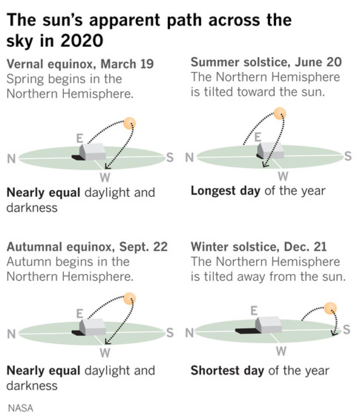
Although the astronomical winter officially arrives in Los Angeles at 2:02 a.m. Monday, the region’s stubbornly warm, dry weather pattern doesn’t show much sign of stopping. It seems like it’s been stuck in a continuous loop all year. California endured record heat this summer and continues to suffer the worst fire season in the state’s history.
Globally, last month was the warmest November on record, according to the Copernicus Climate Change Service, which is the European Union’s climate and environmental observation program.

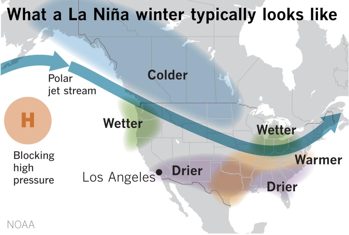
A La Niña — the dry sibling of El Niño — is present in the eastern equatorial Pacific Ocean, and is likely to persist through the winter, according to NOAA.
A La Niña occurs when the sea surface temperatures in the central and eastern equatorial Pacific are below average. Easterly winds over that region strengthen, and rainfall usually decreases over the central and eastern tropical Pacific while it increases over the western Pacific, Indonesia and the Philippines.

During a La Niña winter, the polar jet stream, a strong belt of wind blowing from west to east in the upper levels of the atmosphere, tends to shift further to the north than usual. This pattern increases the chances of below-normal precipitation across the southern part of the United States, and increases the likelihood of above-normal precipitation and below-normal temperatures in the Pacific Northwest.
The Southern California winter outlook through February calls for a 40% to 50% chance of above-normal temperatures and roughly a 40% to 60% chance of below-normal precipitation.
Californians and residents of most of the Southwestern U.S. have their stockings hung by the chimney with care, in hopes that Santa will bring may hope for a wet winter. The most recent U.S. Drought Monitor categorizes 100% of California as at least abnormally dry, and more than 95% of the state as being in some level of drought. More than 21% of the state, mostly in Northern California, is categorized as being in extreme drought.
After a disappointing monsoon season last year, the failure of this year’s monsoon has pushed vast portions of the Southwestern U.S. into exceptional drought. Statistically, a La Niña winter doesn’t promise much relief for the entire thirsty region.

The lack of precipitation has not only left the local Southern California mountains parched and fire-prone, especially when the Santa Ana winds desiccate the landscape, but people in the L.A. Basin can’t look up and see snowcapped mountains in the distance, visual relief that is often possible at this time of year.
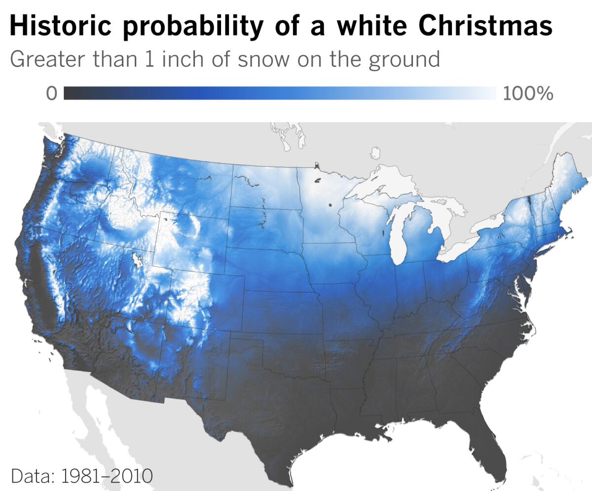
If you’re looking for a white Christmas or for outdoor winter sports and activities, the map above shows where your best bets are likely to be. From Southern California, a fairly lengthy road trip will probably be required to reach areas that have much snow.
More to Read
Sign up for Essential California
The most important California stories and recommendations in your inbox every morning.
You may occasionally receive promotional content from the Los Angeles Times.


